Colorado spring snowstorm will bring big accumulation in areas, affect travel Tuesday through Wednesday


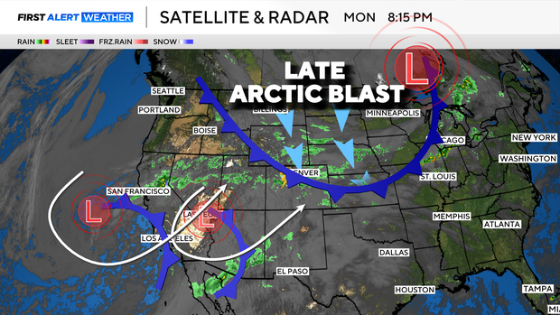
A potent spring snowstorm is getting ready to blast Colorado's Front Range with cold and snow starting on Cinco De Mayo. Both Tuesday and Wednesday are First Alert Weather Days for the major cold shift moving in.
The combination of cold Arctic air oozing in over the Rockies from the north and Pacific moisture makers swinging in from the southwest is setting the stage for a storm that may have travel impacts in Denver and across the state for Tuesday and Wednesday.
The storm system will bring heavy, wet snow that may weigh down tree branches and power lines. This could lead to scattered power outages, especially for areas in and near the foothills.
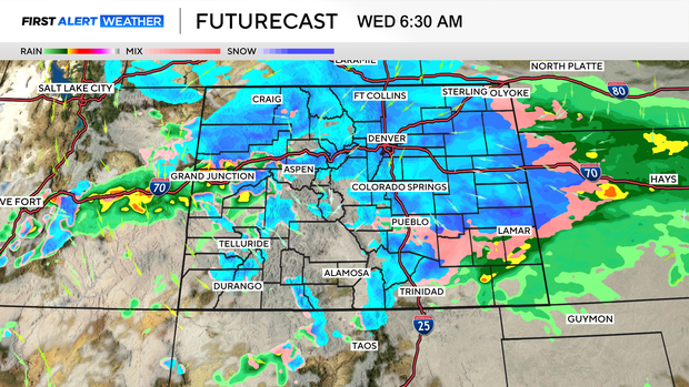
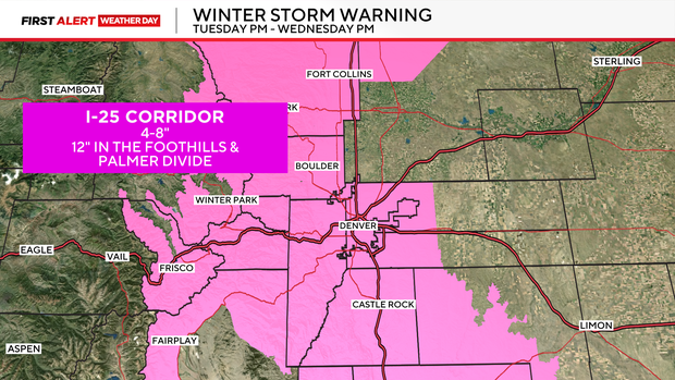
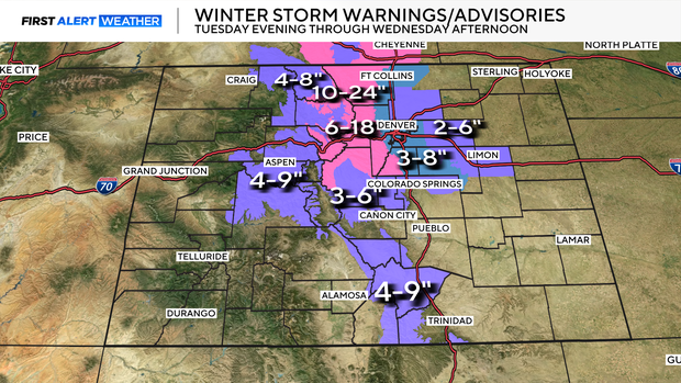
The heaviest snow will pile up in the mountains and foothills where winter storm warnings are in place for as much as 2 feet of snow in some spots starting Tuesday afternoon through Wednesday with two waves of snow surging through.
"Travel conditions could prove quite difficult and create visibility concerns as heavy bands of snow pass through the mountains during this period," the Colorado Department of Transportation wrote in a news release.
The Denver metro area is also under a Winter Storm Warning as 4-8" of snow is possible, with totals climbing closer to 12" for some communities near the foothills and the Palmer Divide.
The Tuesday morning drive will be wet with rain or a rain/snow mix as the morning goes on. More in the way of snow will develop for the afternoon drive with some of it sticking in and near the foothills. Heavier snow will materialize Tuesday night into Wednesday.
"Travelers should prepare for the storm's peak impacts during the Wednesday morning commute, when cooling temperatures will likely lead to snow-covered roads at lower elevations before conditions begin to improve Wednesday afternoon," CDOT wrote.
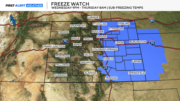
After the snow and rain move out, much colder air will arrive with a hard freeze settling in on Wednesday night. Tuesday night and Wednesday night will both have a freeze.

The hard freeze will be Wednesday night into Thursday as skies clear out. There is a freeze watch in place for all of eastern Colorado Wednesday night into Thursday morning.
The southern Sangre De Cristo mountains are also included in a winter weather advisory for 4 to 9 inches of snow Tuesday through Wednesday.
CDOT warned that some highways and roads could be impacted by snapped limbs landing on the road.
If you've got a photo from this spring storm to share with CBS Colorado, click here.


