Hurricane Irene: What Are The Primary Threats To Southern New England?
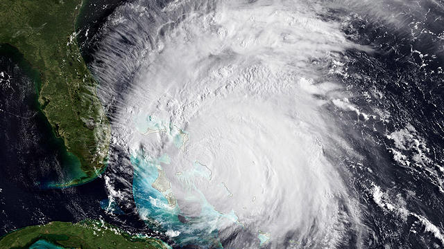
As Category 3 Hurricane Irene continues to churn through the Bahamas, folks along the East Coast are keeping a close eye on the projected path and forecasted strength.
Watch CBS News
As Category 3 Hurricane Irene continues to churn through the Bahamas, folks along the East Coast are keeping a close eye on the projected path and forecasted strength.

In less than 24 hours, Hurricane Irene has grown from a Category 1 to a Category 3 hurricane, what is considered to be a "major" hurricane.

Sunday appears to be the day of greatest concern here in New England, when the majority of rain and wind would occur from Hurricane Irene.

If you are having trouble growing the perfect garden in your backyard, chances are the problem may lie beneath the surface.

There is a chance that Boston could equal or eclipse the all-time record for hottest temperature ever recorded in the city, set way back in 1911.
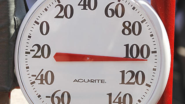
For many cities and towns, Wednesday will mark the first day of a four-day blistering heat wave.

Although the region has been spared so far from severe weather, we cannot completely let our guard down.
After the storms exit Monday, our attention will turn to the building heat across the eastern half of the country for the mid-to-late portion of this week

There will be a cold front moving through our area Sunday evening with some fairly significant showers and thunderstorms.
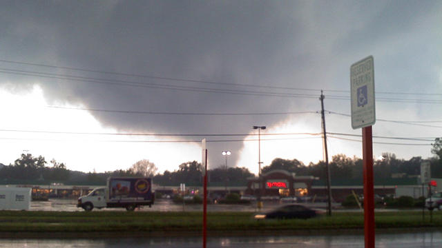
Wednesday's tornado outbreak is likely the most violent weather event to occur in Massachusetts in many of our viewers' lifetimes.

Massachusetts has had 155 tornadoes since January 1950 (61 years). That comes to 2.5 a year.

This week on Gardening With Gutner, Todd traveled to Parlee Farms in Tyngsboro, MA, where he met with bee keeper Andrew Reseska.

We have had several viewers write in and ask about tree related pollens and pests.
The best chance for any severe storms in our vicinity would be in western New England - places like the Berkshires, Vermont and Connecticut. But tornadoes are very unlikely.

You can expect a rainy Saturday, with steady rain falling in the morning and early afternoon. It should taper somewhat in the evening.

It has been a gloomy stretch lately and this Easter Weekend may not be a whole lot better.

Marathon Monday continues to look like a nearly ideal day for running!

Here is the latest on the forecast for this weekend and Marathon Monday.

The key to the forecast for Monday continues to be the storm system that will be bringing us rainfall this weekend.

We have finally reached a reasonable timeframe to start giving an idea of what runners may be facing next Monday.

We never had a winter thaw and really haven't been able to put together a string of unseasonably warm days this spring yet either. Until now.

We got a couple of great viewer questions regarding early season gardening and Mark Saidnawey from Pemberton Farms helps us out with the answers...

Heavy, wet snow fell at sunrise on April Fools' Day, letting everyone know this nagging winter isn't quite over yet.

Temperatures are so borderline that a difference of just one or two degrees could mean very little snow or several inches.
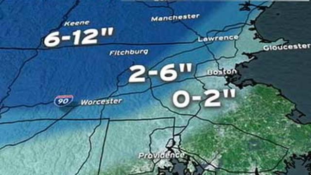
There will likely be a significant, heavy and wet snow in parts of northern Worcester County, all of western Massachusetts and in southern New Hampshire.