Watch CBS News

Canada

joe-joyce.jpg

Plenty To Look Forward To....

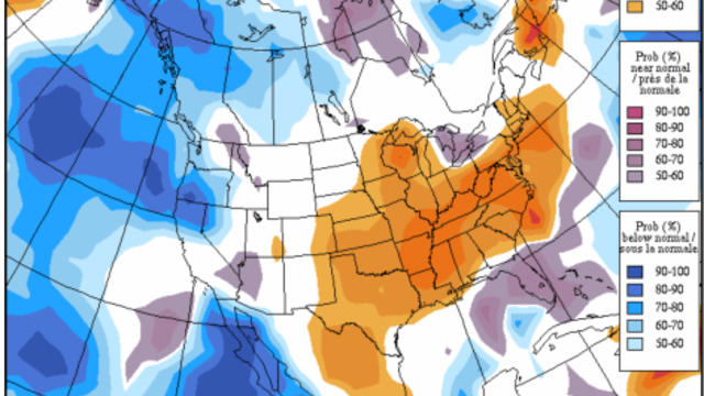
Clouds have moved in this morning ahead of a warm front. This front is the leading edge of some warmer air which will move in for Valentine's day. Along this front is a vortmax which will slide through SNE during the midday and afternoon. A line of snow showers is pushing through eastern NY and and enter the Berkshires, CT, and S. VT later this morning and will move east during the afternoon. A light coating to 1" is possible in the western hills...otherwise most of us have the chance of a passing flurry or snow shower this afternoon.

joe-joyce.jpg

Another Headlining Winter Storm For The Nation

A mix of sun and clouds will fade to increasing clouds as the disturbance moves through. Upper level winds are helping to shear this apart with snow weakening over PA and NY. This disturbance will try to provide a little light snow shower activity and flurries south of the Pike for the mid-late afternoon into the early evening. Not expecting much more than a coating to 1" in places especially in CT, RI and Southeast MA...if at all as most of the snow will fall apart and stay away.

joe-joyce.jpg

Extreme! Arctic Blast to Midweek Nor'easter

The newly fallen snow is adding to the chill this morning in the single digits and teens. 850 mb temps near -15C will help keep temps in the teens and lwr 20's today. We are tracking an arctic front currently in place ver the Great lakes and Canadian border. This will approach from the west tonight with increasing clouds and a chance of a few flurries by dawn. Once this front pushes off the coast tomorrow..the cold arctic air will begin to plunge into the region with the coldest air to be found Sunday Night-Early Tuesday.

View CBS News In
CBS News App Open
Chrome Safari Continue