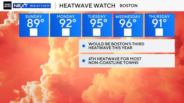
Boston faces third heat wave this week and there's no significant rain in sight

Boston is facing the third heat wave of the summer this week and for many towns in Massachusetts, it will be heat wave number four.
So far, 16 days have been at or above 90 degrees at Logan Airport in Boston, all of them in June and July. August actually started on a different note. The first week of the month was the coolest start to August since 1976. Now, temperatures are about to flip fast.
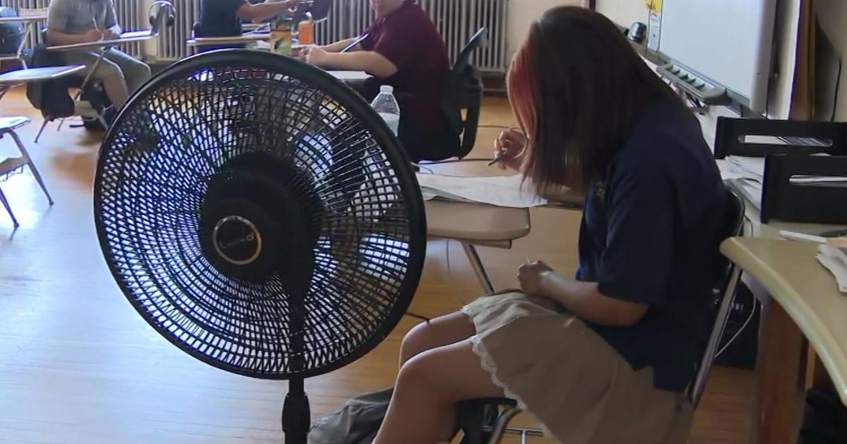
Boston will hit the low 90s Monday, then the mid-90s on Tuesday. Wednesday could be the hottest day yet, flirting with the mid-to-upper 90s. Fortunately, the hottest days don't coincide with the super high dew points. Yes, it will be muggy, but the good news is it won't be the oppressive, swampy weather we had earlier this summer.
No significant rain
It's not just the heat. it's the lack of rain. The next two weeks look hot with very few rain chances showing up on the long-range forecast. Lawns and gardens will be feeling it, and so will reservoirs if this pattern holds.
"Significant drought" conditions were noted on Cape Cod last week, and that could spread further without any rain. The best chance for rain over the next week is Thursday. At the moment, it just looks like some light showers.
Next hurricane?
While New England bakes, the tropics are heating up in their own way. Several tropical waves are moving across the Atlantic Ocean, and one disturbance moving off the coast of Africa has a decent shot at developing over the next few days.
Late August through September is peak hurricane season, so this uptick in activity is right on schedule.
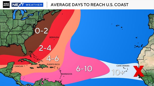
We're still days away from having any kind of reliable forecast track if this disturbance were to strengthen into Tropical Storm Erin. For now, it's just too far out and tropical models don't lock in on a storm's path until it's better organized and has a well-defined center. Until then, it's a "watch and wait" situation for meteorologists.
A cold front is set to arrive in Massachusetts Thursday, knocking temperatures back into the 80s and bringing slightly cooler, drier air. But the relief may be short-lived as long-range models hint at more above-average heat as we head deeper into August.