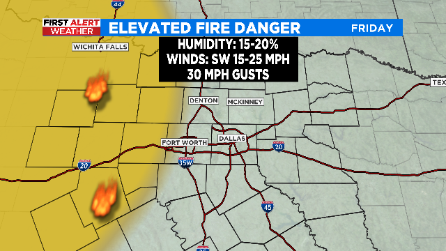
After Friday In The 60s High Temperatures Keep Climbing, Elevated Fire Danger Remains
A tranquil weather pattern will lead to warmer days ahead across North Texas.
Watch CBS News
A tranquil weather pattern will lead to warmer days ahead across North Texas.
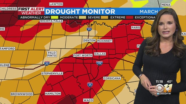
11AM Weather Update With Anne Elise Parks
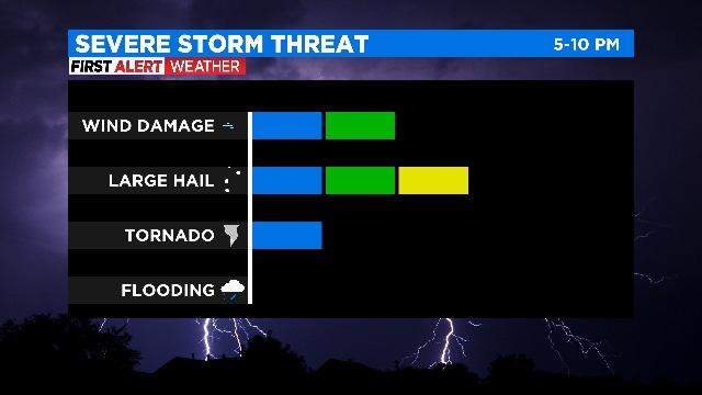
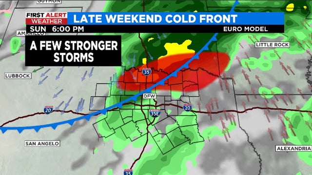
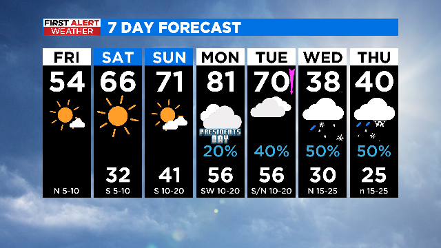
One week we're talking winter weather and the next week we're in the throes of spring, with the potential for severe storms.
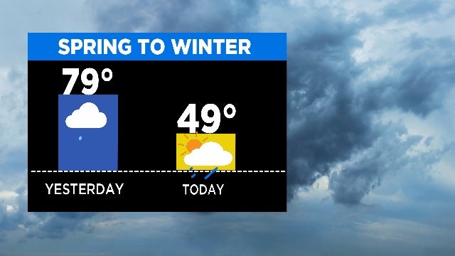
The saying 'If you don't like the weather just wait a few minutes.' will certainly apply to the week ahead as North Texas experiences multiple seasons over the next seven days.
In the 9:00 a.m. hour temperatures were already warming into the upper 50s and low 60s and we're on track to see highs top out near 80° this afternoon.
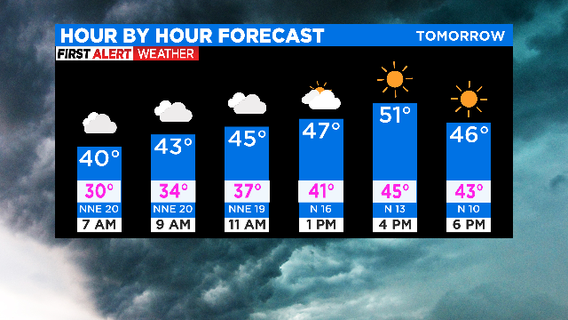
We follow up a beautiful Friday with another cold night. Temperatures are a touch warmer Saturday morning but still in the lower 30s.
Nothing but sunshine and highs near 80°. But keep those sunglasses handy and hold on to your hats because southwesterly winds are picking up today.
Temperatures are looking up as North Texans rounds out the workweek. On Wednesday high temperatures hit 70°, today we are going for 73°.
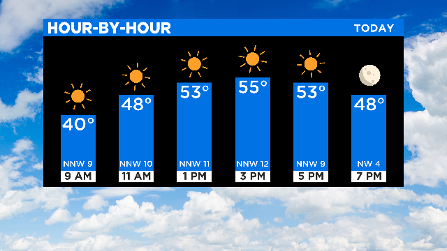
This afternoon sunshine is the name of the game and we should have it in spades through the upcoming week.
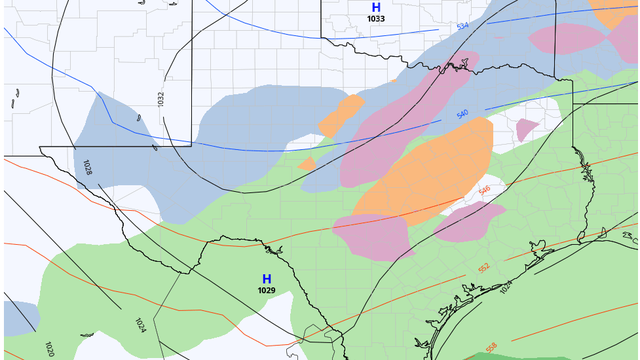
The First Alert Weather Team is sniffing out changes, maybe big changes, that could lead to a series of arctic fronts and the chance of wintry weather.
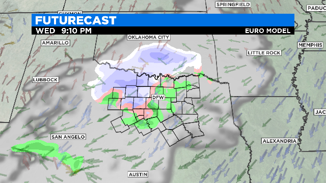
A disturbance is passing to our south, and will keep cloud cover along and south of Interstate-20 throughout the day.
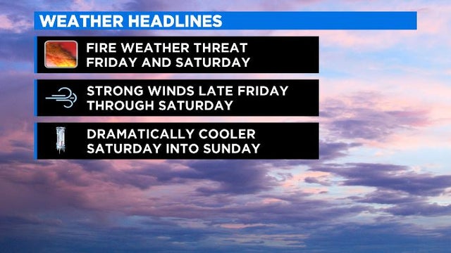
Wind chills will be in the 20s and 30s throughout the day Saturday and into Sunday morning temperatures will fall into the mid 20s and wind chills will be in the teens.
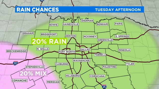
The workweek is starting off on a brighter note as the sunshine is back in North Texas. Monday will be a typical winter day, but we could see winter weather Tuesday.
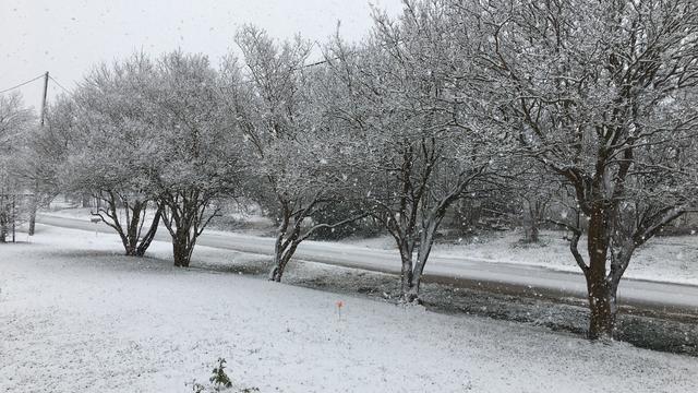
It wasn't just North Texas that had snowfall over the weekend. In addition to the Lone Star State the winter storm blew across Louisiana and Mississippi on Sunday, then moved into Alabama and Tennessee on Monday.
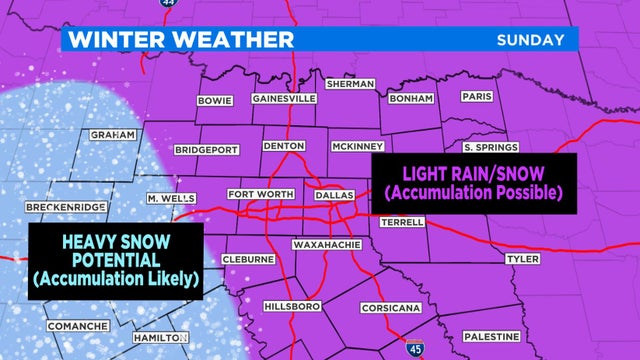
It was just over a week ago when parts of North Texas received snow to ring in the New Year. Now, the area is bracing for another dynamic winter system that's set to arrive on Sunday.
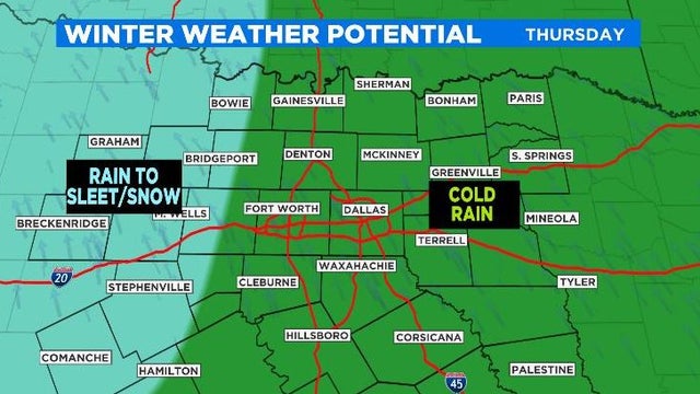
The year 2020 is determined to take North Texas on one final weather rollercoaster ride. Highs Tuesday were in the 60s and low 70s, but be prepared for temperatures to be 20° to 30° cooler by Wednesday afternoon.

Widespread rain begins overnight December 29 and continues through Wednesday, Dec. 30. According to the National Weather Service, models show the possibility for snow in North Texas on New Year's Eve.
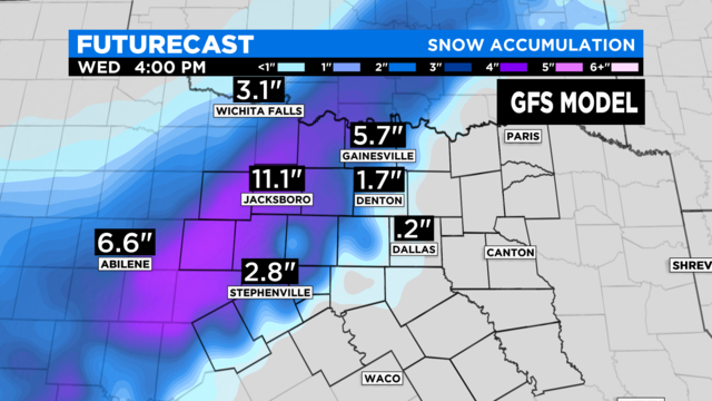
During the last five years at DFW Airport, a total of 0.3" of snow has been recorded. That includes the 0.2" that fell back on January 11.
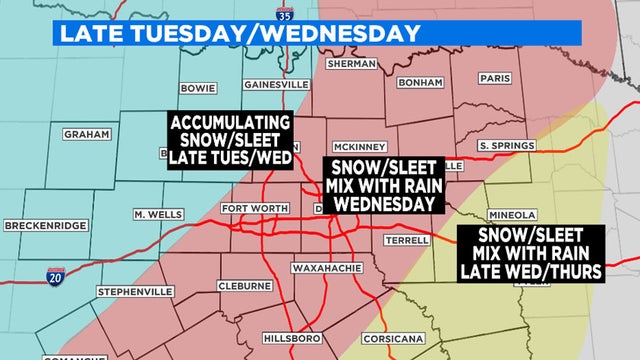
From a near record-high on Sunday to winter weather possible Wednesday, North Texas is in for a roller coaster ride this week.
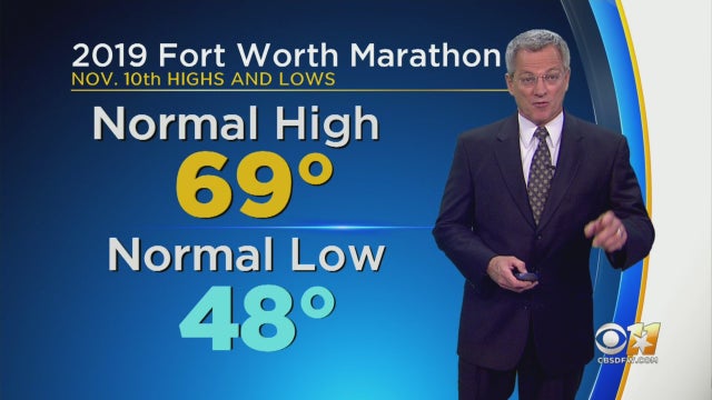
Jeff Ray has details on what weather may be like on race day morning.

A tornado touched down in North Texas Sunday night — leaving damage across Dallas, Richardson and other parts of the Metroplex.
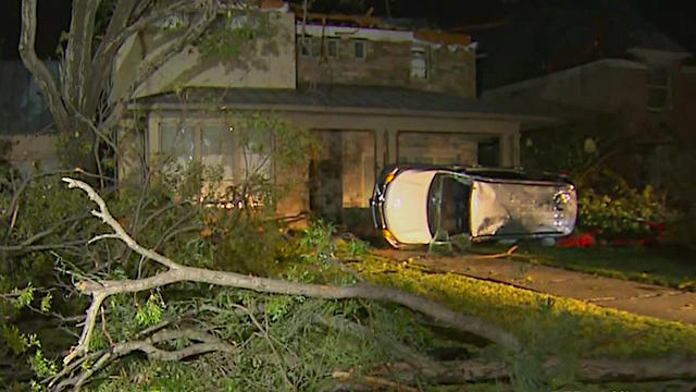
The Dallas Police Department is urging Dallas residents in areas hard-hit by Sunday night's EF-3 tornado to remain indoors from 7 p.m. - 7 a.m. Monday through Thursday.
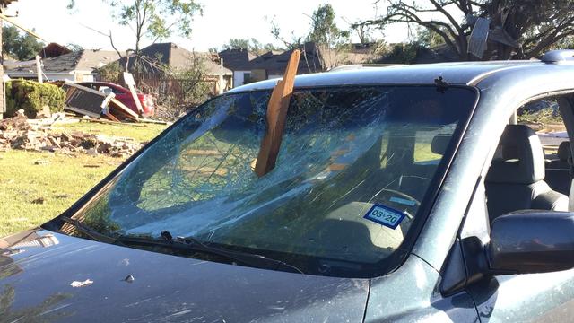
Despite multiple reports of downed trees, fences and several downed power lines only eight homes sustained moderate damage in the area, according to police.
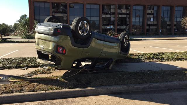
The declaration includes Cass, Cameron, Collin, Dallas, Ellis, Erath, Hunt, Kaufman, Lamar, Panola, Rains, Rockwall, Rusk, Tarrant, Van Zandt and Wood counties.
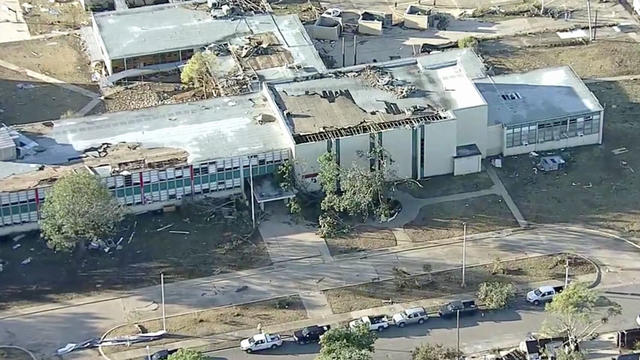
The National Weather Service confirmed a tornado touched down in Dallas and resulting storm damage has closed schools across North Texas.