Quick Moving System Will Spark Scattered Storms, Some Possibly Severe, Across Metroplex
NORTH TEXAS (CBSDFW.COM) - One week we're talking winter weather and the next week we're in the throes of spring, with the potential for severe storms.
CBS 11 Meteorologists are watching as a quick moving storm system makes its way to North Texas. It is expected to spark scattered, strong-severe storms for the Metroplex and points east between 5:00 p.m. and 10:00 p.m.
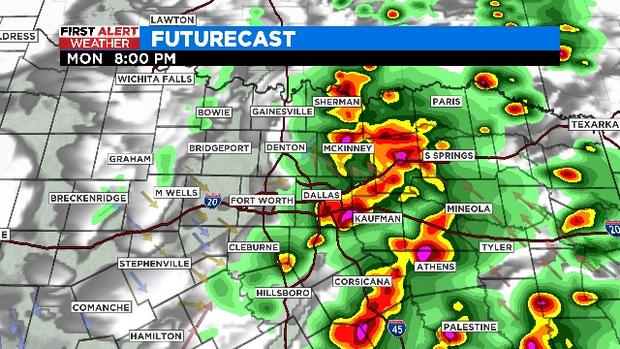
A cold front is set to swing through the region Monday evening. Along the front, scattered storms are likely to develop sometime between 5:00 p.m. and 6:00 p.m. The best chance for storms will be right around the Interstate-35 corridor.
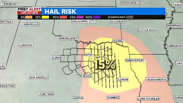
The storms will likely increase in coverage as they roll east through the evening. The main threat from the storms across DFW will be large hail -- up to golf ball size. The main threat for counties to the east will be damaging winds -- up to 60 mph.
After tonight's quick round of storms, we're in for a quiet, beautiful Tuesday with low humidity and slightly lower temperatures.


