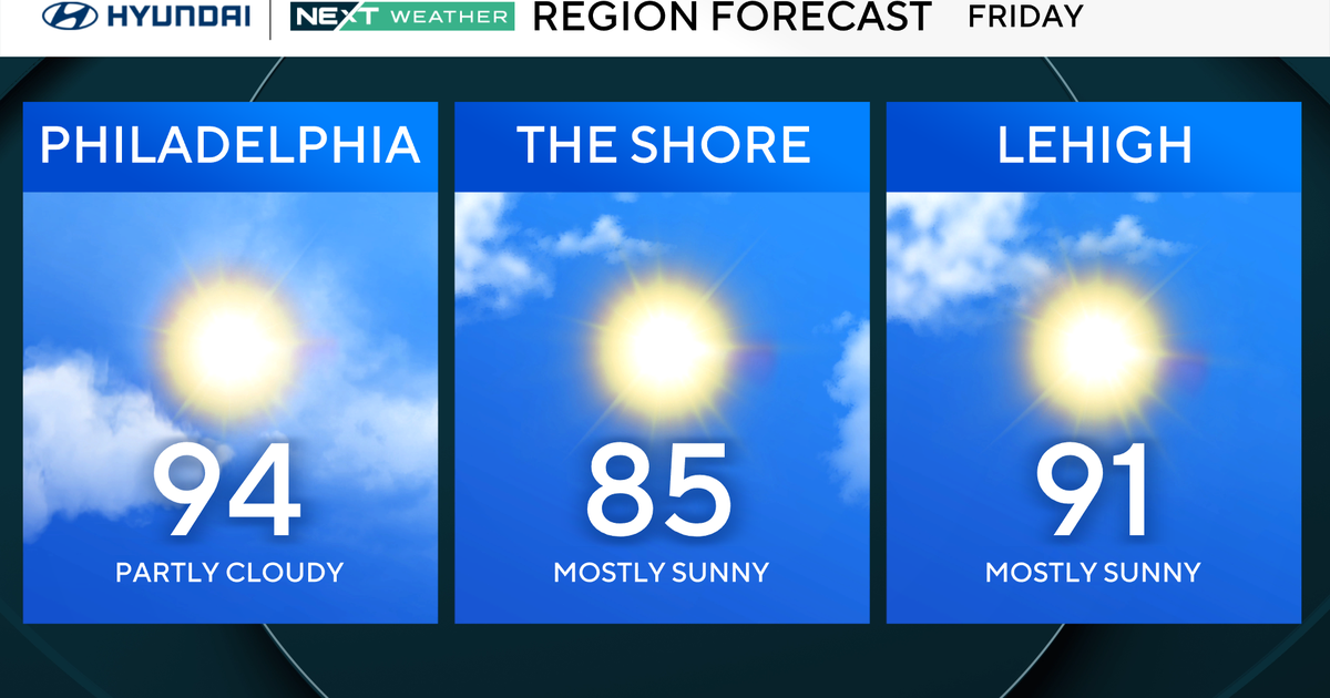
Highs in the mid to upper 80s Tuesday and Wednesday
NORTH TEXAS — It's been a warm Monday. It's been a muggy Monday. But it hasn't been a stormy Monday, at least not yet.

Storms are beginning to develop well to the west of us, out towards Midland. These storms should move east/northeast tonight, but they will be moving into a less favorable environment (capped).

The counties highlighted in yellow are under a Tornado Watch until 9 p.m.

Stephens and Young counties are included in this, but still well to the west of DFW.

As you look at the progression of these storms to the east, displayed with First Alert Futurecast, you can see the storms weaken. Still, some gusty winds and brief heavy rains will be possible for parts of the DFW metroplex – likely through midnight.


Some rain may linger to the east early Tuesday morning, but by Tuesday afternoon it'll be partly cloudy, warm and muggy. Next up for severe weather potential, is Thursday.

Parts of North Texas are highlighted for the threat of severe storms Thursday afternoon and evening, but there will likely be a cap in place – at least through part of the day.

Once we get to the weekend, some heavier rain is expected late Saturday/overnight. The severe storm threat looks lower, but the flooding threat may increase overnight for parts of North Texas. It won't be the most ideal spring weekend for North Texas.