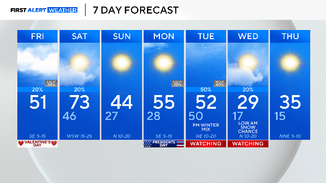
Valentine's Day brings cool temps, spotty showers to North Texas ahead of weekend shifts

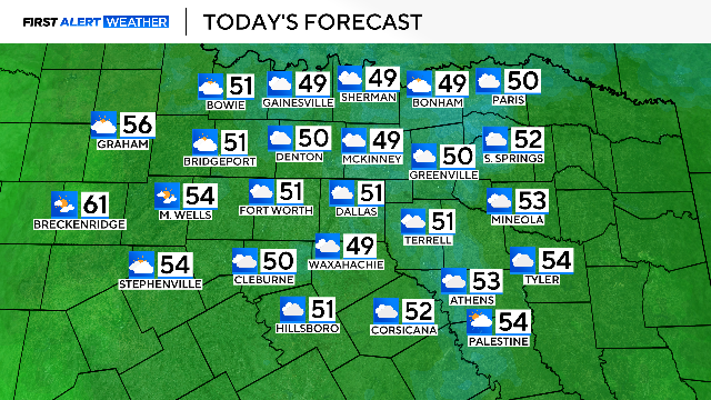
North Texas has partly cloudy skies and temperatures in the 30s on this Valentine's Day morning.
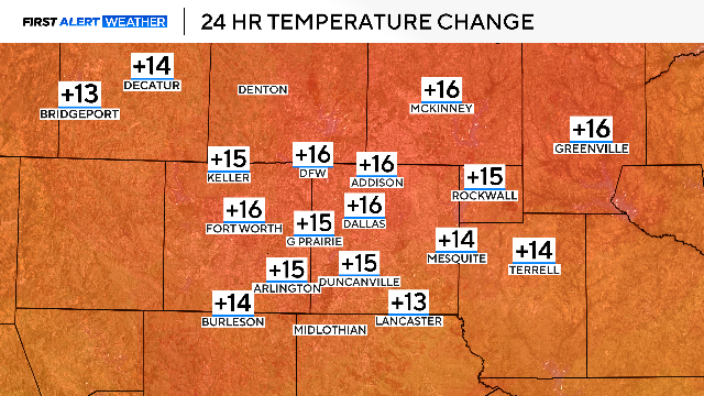
Temperatures are about 15 degree warmer than this time yesterday — a sign of the warmer airmass on the way into the beginning of the weekend.
Plan for a cool Friday with a small rain chance. High temperatures will warm to the upper 40s and low 50s.
The surface wind flow turns more south-southeast, tapping into more low-level moisture. The moisture increase keeps the cloud cover in place and introduces small rain chances this afternoon into the evening hours.
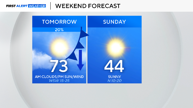
The shower chances continue Saturday morning into the afternoon east of the 35 corridor ahead of the strong cold front that will usher in yet another cold air mass into the evening.
With highs Saturday in the low 70s to then highs Sunday in the mid 40s, it will be another weekend with a tale of two seasons.
The First Alert Meteorology Team is watching next Tuesday to Wednesday for the next big weather change.
A storm system moves into North Texas, sending temperatures plummeting on Tuesday afternoon into Wednesday.
The challenge is the precipitation in the forecast. The long-range forecast models latest run has lower precipitation chances, but the timing is still questionable. There is a low-end chance for cold rain then mix with some snow into Wednesday morning, but there is still a lot of uncertainty.
The cold air behind the cold front is likely to drop morning temperatures into the teens on Wednesday and Thursday morning.