Flash flood warnings issued as threat of strong to severe thunderstorms continue in North Texas


Flash flood warnings have been issued for part of North Texas, as heavy rain and thunderstorms hit the area Saturday morning.
The warnings are in effect for Collin, Dallas, Denton, Lamar, Tarrant and Rockwall counties until 8:30 a.m. Saturday.


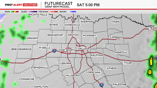
Expect heavy, widespread showers and thunderstorms throughout Saturday morning. Some of the storms have the potential to turn severe, with a large hail threat primarily.
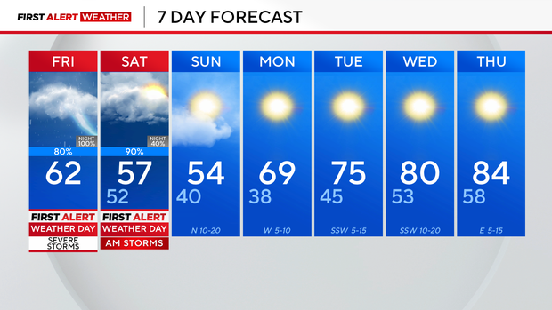
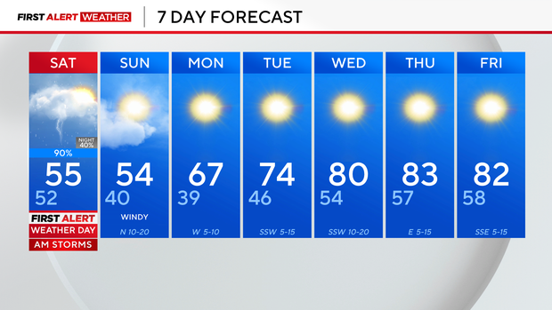
By about 9 a.m., most of our severe threat wraps up, and we'll just be left with clouds and isolated shower activity into the afternoon and evening.

We'll also be fairly breezy through the upcoming weekend as a reinforcing shot of cool air sends temps into the 50s.
Sunday morning starts with clouds, then they'll gradually break into the afternoon. Highs top out in the middle 50s, with breezy conditions.
We've got a nice and needed stretch of sunshine next week, with highs in the upper 60s on Monday, eventually working back to the 70s and 80s by midweek.
Earlier Friday, the National Weather Service issued a tornado warning spanning parts of several counties in North Texas.
Van Zandt, Hopkins and Henderson counties were the latest to have been under tornado warnings.
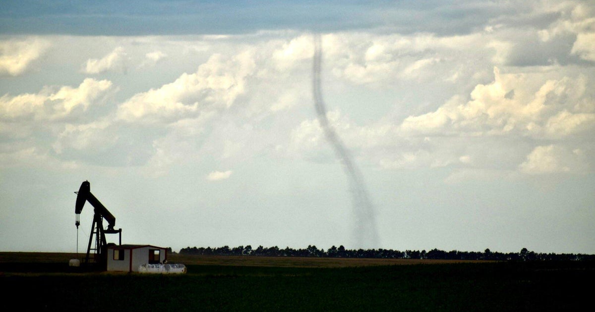
A confirmed tornado was on the ground near Grand Saline and heading from Van Zandt and into Wood County, according to CBS News Texas meteorologist McKenna King. Reports are of a tree on a house and a roof blown off a house in Van Zandt County, King said.
Other confirmed tornadoes have been reported near Clarksville in Red River County and Hagansport in Franklin County, she said.
Parts of Navarro, Henderson, Hopkins, Delta and Lamar counties fell under the warnings, the last of which expired at 3:30 p.m.
In addition to tornadoes, the storm system moving through the region has the potential for producing quarter-sized hail. The National Weather Service warned of dangerous flying debris and likely damage to homes and vehicles.
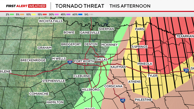
Friday is a First Alert Weather Day due to the chance of storms. All of North Texas is under a slight risk for severe storms on Friday.
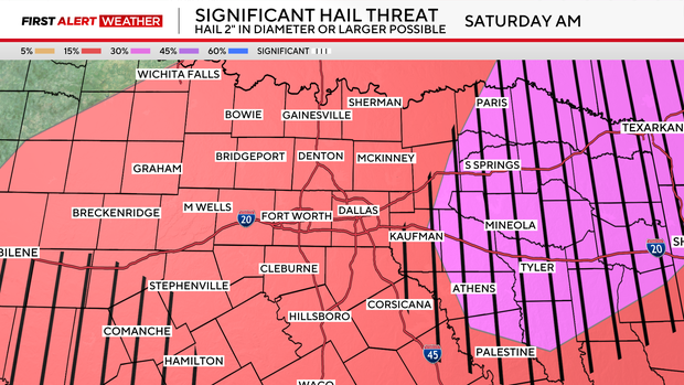
There's also a significant hail threat for parts of North Texas. Hail 2 inches in diameter or larger is a possibility.

Another round of widespread heavy rain and a few strong to severe storms return overnight into Saturday.
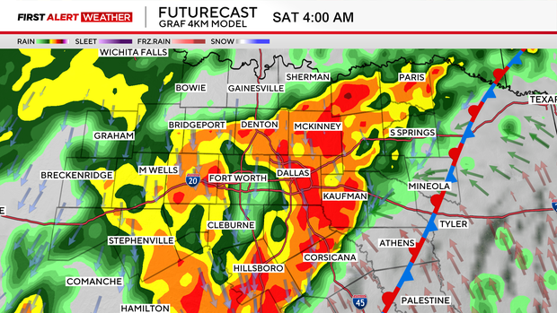
Hail and damaging winds will once again be the primary threats for Saturday. There's also a flood threat, especially for northeastern counties, where hefty rain totals are expected. Because of this, the NWS issued a flood watch for that area from 1 a.m. Friday through 6 a.m. Sunday.