North Texas temperatures will rollercoaster into the weekend and warm holidays


Thursday was a mild and breezy day in North Texas, with those winds especially picking up as a cold front worked through the region this afternoon.
That front ushered in much drier air, and following its passage, we will hang onto the breeze as we head into Friday.
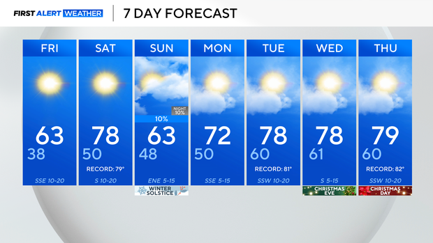
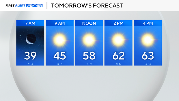
Friday morning will start off chilly, but near-normal for the region, with lows in the 30s. Highs then warm to the lower 60s, which is several degrees cooler than Thursday, but still above-normal for this point in the year. The average currently is the upper 50s.
Due to warm temperatures, low humidity, and a strong breeze, we do have an elevated fire threat, especially for areas along and west of Highway 281 through Saturday.
By Saturday, the return of southerly flow warms our temperatures back into the upper 70s, and within a degree or so of records.
Another cold front knocks temperatures back into the lower 60s Sunday, with increased cloud cover, and just an isolated sprinkle chance.
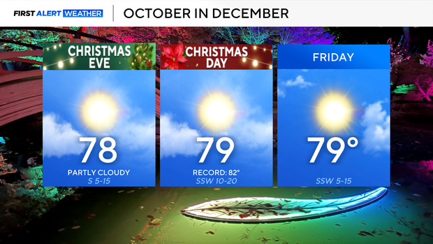
Outside of that, the forecast remains dry, with a steady warm-up for the holiday week.
We're looking at temperatures in the upper 70s for the holiday. The current forecast puts us in the top 5 warmest Christmases on record.
This means no white Christmas for North Texas, which is normal, but we will be 20-25° above normal in the way of temperatures.