First Alert Weather: Heavy rain, strong storms possible across North Texas Thursday
NORTH TEXAS (CBS News Texas) – Heads up! Today is a Weather Alert. Heavy rain and strong storms are possible.


A cold front will slide into North Texas as we move through this Thursday, giving way to on and off rain and a few thunderstorms. A few storms could be strong or severe. Any storms that develop could produce gusty winds and some hail. We can't rule out an isolated tornado.

The Storm Prediction Center has posted a Level 1 Risk (Marginal) for strong to severe storms in North Texas. If you're traveling southeast toward the Houston area, stay alert. There is a higher threat for severe storms and tornadoes are possible.


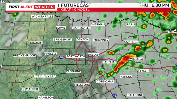
Back in here in DFW, there will also be a few pockets of heavy rain here and there today, capable of producing some localized flooding.
Otherwise, expect mostly cloudy skies. Highs will be in the lower 60s.
Tonight, the rain will be east of North Texas. We'll see partly cloudy skies. Low temperatures will be in the mid 40s.
With the front southeast of the area by Friday, highs will sink into the upper 50s to near 60. We'll see a mix of sun and clouds.

On Saturday, our highs will rebound to near 70 degrees by the afternoon. Highs will be in the mid to upper 70s Sunday. We'll see dry weather this weekend.

Highs will be in the mid 60s Monday through Wednesday of next week.