Deadly tornadoes and winds strike North Texas; conditional risk continues Sunday

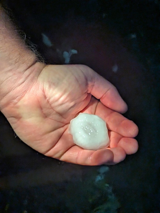
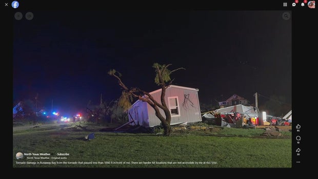
Tornadoes, large hail, intense straight-line winds, and significant flash flooding was witnessed across North Texas Saturday night. Sadly, the storms were deadly.
One supercell in particular ignited around 4 pm in Wichita County and violently intensified as it moved southeasterly. This was the destructive storm that lasted nearly 12 straight hours, dissipating around 3:30 am Sunday morning.
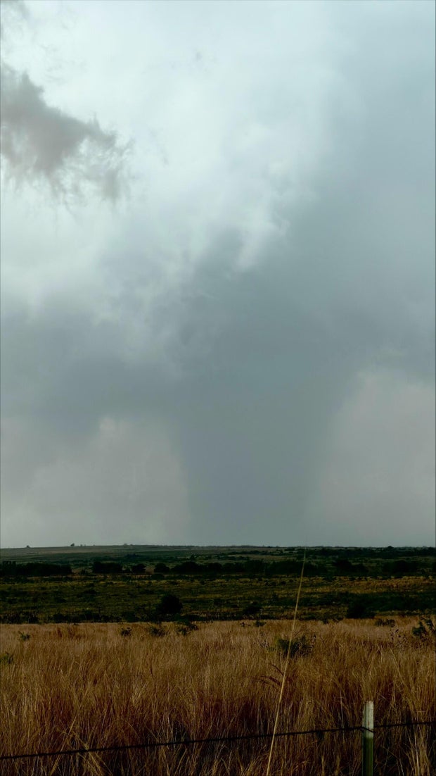
A dryline to the west was the key trigger for this devastating storm. Again, the dryline will play a role in Sunday's forecast.
There is an isolated severe threat due to the same atmospheric setup in the afternoon and evening. However, the cap in the atmosphere is a lot stronger, meaning the risk for severe weather will still remain a possibility, but the likelihood of any initiation that is strong is extremely low.
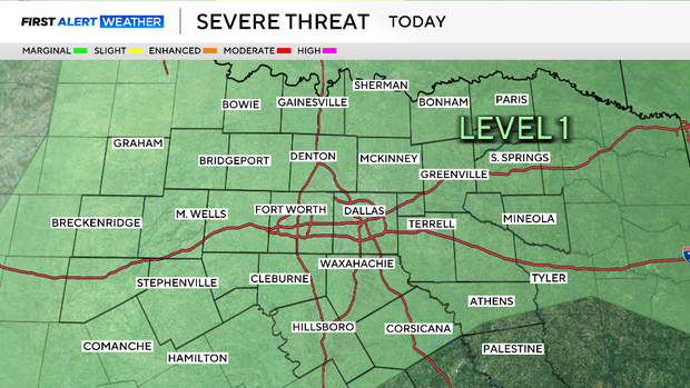
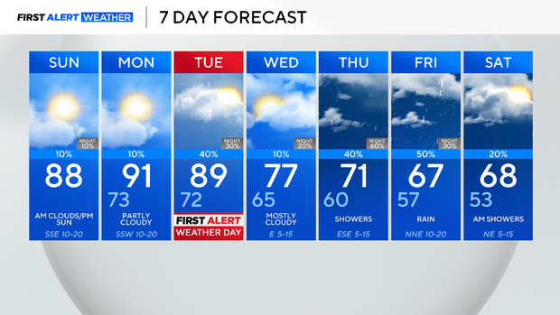
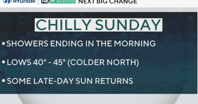
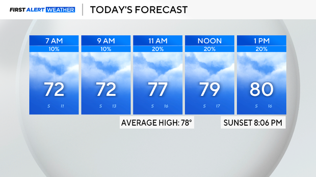
Expect most of the area to stay dry and conditions to be a muggy, breezy, and cloudy day with a conditional threat of severe weather. Highs will be in the upper 80s and winds will come from the southeast gusting around 25 mph.
Another First Alert Weather Day is issued Tuesday as the Storm Prediction Center, SPC, has highlighted most of North Texas under a risk for severe weather, especially counties to the northeast of the metroplex. This is due to a cold front that will swing across the area.
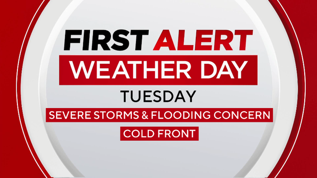
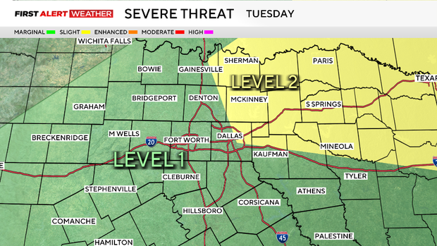
All modes of severe weather will be possible, including damaging winds, hail, flooding, and even a tornado. Now is the time to prepare. Be sure to stay alert and have a safe place as well as a plan in case a severe storm passes through your area.
Throughout the next week, there is a daily shot of rain and storms. The good news is that the front will bring cooler weather and rain to drought-stricken areas to the east. Stay tuned!