North Texas winter storm nears, dangerous cold and ice expected


There are now fewer than 48 hours before the impactful arctic winter storm moves across North Texas.
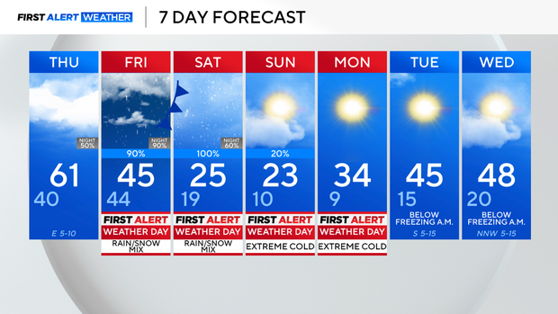
That being said, Thursday will be the perfect day to winter-proof your house and get all the supplies needed for a stay-at-home weekend. The forecast for Thursday includes a low in the 40s, a high in the mid-50s, with mostly cloudy skies and a slight breeze from the southeast.
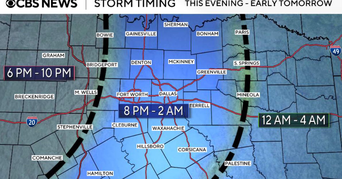
Thursday night, light rain showers begin and will continue throughout the day on Friday. The cold front will move through North Texas during the day on Friday, meaning that the high temperature will be in the morning.
Temperatures will drop throughout the day, which will eventually lead to rain transitioning into a wintry mixture. The exact timing of this transition is still being ironed out, but see the graphic below for a general idea of when to expect the wintry weather to start in your area.
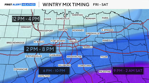
Outlook on wintry mix
Confidence is increasing that the sleet and freezing rain threat will linger through the day on Saturday. The transition to snowfall is likely to happen early Sunday morning, with the wintry precipitation wrapping up and pushing to the east by the afternoon.
A winter storm watch is in effect across the region for the potential of moderate to heavy accumulation of ice, sleet, and/or snow. The totals and what type of precipitation are currently uncertain, but the longer-range forecast models are starting to narrow the range of what to expect.
The ice accumulation will likely be anywhere from 0.5 to 1", and the snow accumulation will possibly be around 1 to 5.5" for DFW.
This is just an idea of what might happen; the forecast is still several days away and the temperature profile of the environment, as well as the timing of the system, will be heavily dependent on what the actual snow and ice total will be.
In addition to the wintry precipitation, the frigid arctic air will plunge into the area by Saturday. The coldest air will arrive Saturday night through Monday afternoon. The cold air combined with gusty winds from the north will dip the windchill value as low as -10 degrees. This is dangerously cold.
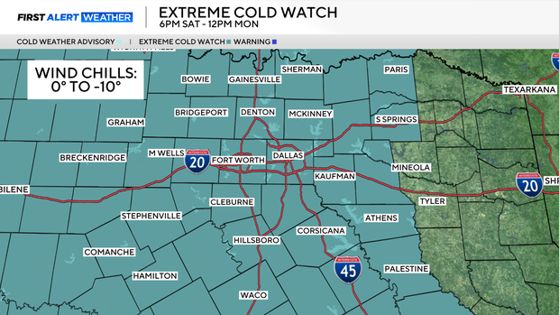
It is crucial to plan ahead by wrapping your pipes, dipping your faucets, and bringing any pets indoors this weekend through Monday, as the forecast is calling for over 72 hours of temperatures being at or below freezing.