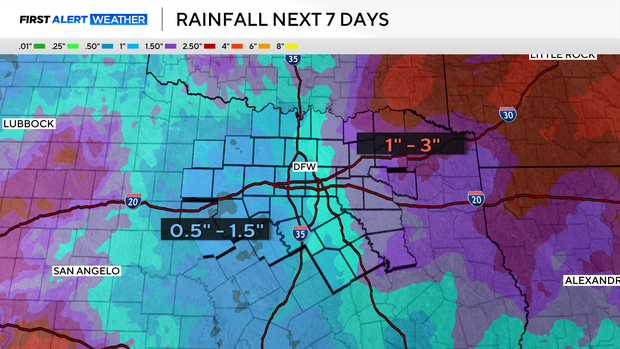
Chances for showers return across North Texas and continue into Halloween ahead of strong cold front


The clouds have settled in across North Texas, and they're here to stay for a couple of days as tropical remnants move up the Mexican Plateau and head into the Lone Star State.
This tropical moisture will bring us scattered shower activity, primarily along and west of I-35 as we head through Thursday evening and overnight into Friday.
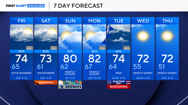
Shower activity primarily sticks west of I-35 throughout the day Friday as well, until the evening hours, when those showers begin pushing farther east.
Lingering shower activity continues into Saturday morning, but does look to clear up for the most part by afternoon.
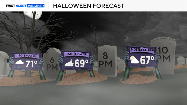
For Halloween evening, expect temps in the low 70s near sunset, with only an isolated shower chance, mainly dry conditions. Temps will then fall through the 60s through the overnight hours. It will be a muggy holiday, with cloud coverage even after the rain clears.
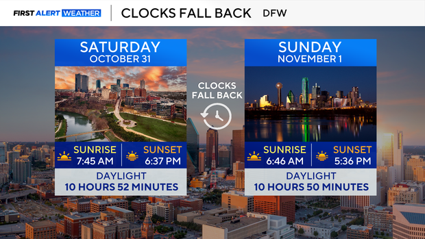
Then we fall back! The sun rises earlier on Sunday morning, and it sets during the 5:30 p.m. timeframe. Sunday is a mainly dry day, with partly sunny to mainly cloudy conditions.
Then we're eyeing our next system early next week. Current outlook brings a strong upper-level trough and cold front into the region later in the day Monday and into Election Day on Tuesday. We'll keep a close eye on timing here, but we are looking at heavy rain for some, along with the chance of a few stronger thunderstorms.