Snow, sleet falling as temperatures drop below freezing across North Texas during winter storm


We have seen rounds of sleet and freezing drizzle with some snow throughout Saturday, and this pattern continues into the night. Additional accumulations are expected. A winter storm warning and ice storm warning (for parts of our area) continue through midday Sunday.
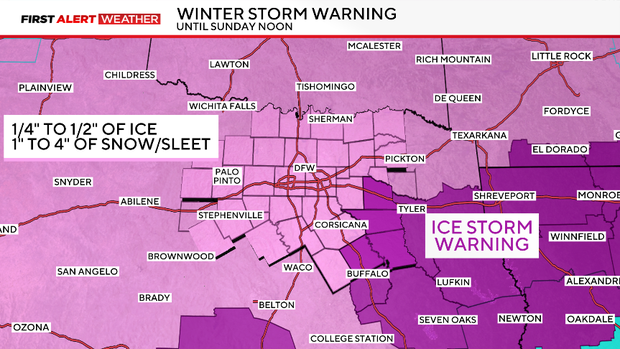
Icy roadways will continue overnight, and there will still be that risk of power outages as sleet and ice accumulate into Sunday.
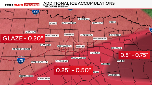
Some locations could still pick up another quarter to half an inch of ice as we move into Sunday.
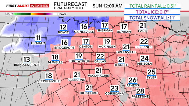
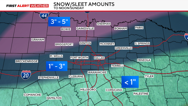
Please continue to avoid travel if you can. Some areas near the Red River may pick up close to 5" of snow and sleet. It will be mainly sleet across the metroplex.
As of 3:50 p.m., according to the National Weather Service, DFW Airport is up to 0.9" of sleet and 0.1" of ice accumulation.
Once all of the wintry precipitation tapers off, expect the dangerous cold to set in.
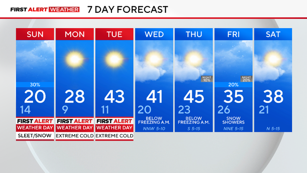
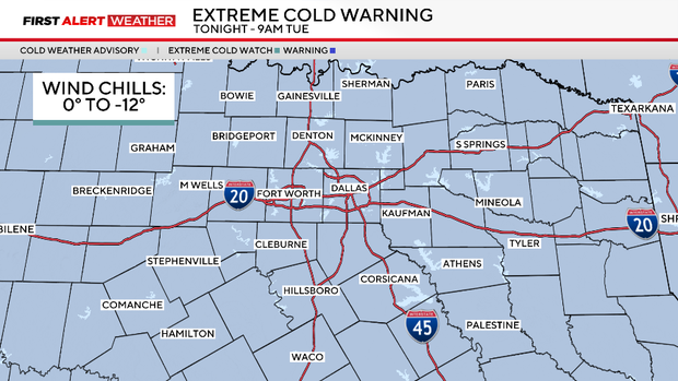
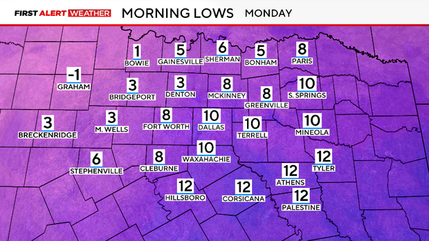
We have an extreme cold warning that begins Saturday night and continues through Tuesday. Wind chills could get as low as -12°. We will stay below freezing, likely for a total of almost 80+ hours until midday Tuesday.
In addition, an extreme cold warning is in effect from this evening to noon on Monday. Wind chill values will be dangerously cold; in fact, temperatures may feel like 0 to -10 degrees.
Texas winter storm power outages
Strong winds, along with ice on tree limbs and power lines, could cause sporadic power outages Saturday and Sunday.
As of 10 p.m. Saturday, over 12,300 Oncor customers are without power, according to the outage map. In Tarrant County, just over 2,200 customers are without power, while in Dallas County, just over 900 customers are without power.
However, Oncor has not reported any major blackouts in DFW.
How long is the winter storm warning in effect?
A winter storm warning is in effect for hazardous winter weather until Sunday at noon. In addition, an extreme cold warning is in effect from Saturday evening to Tuesday. Wind chill values will be dangerously cold, and temperatures may feel like 0 to -12 degrees.
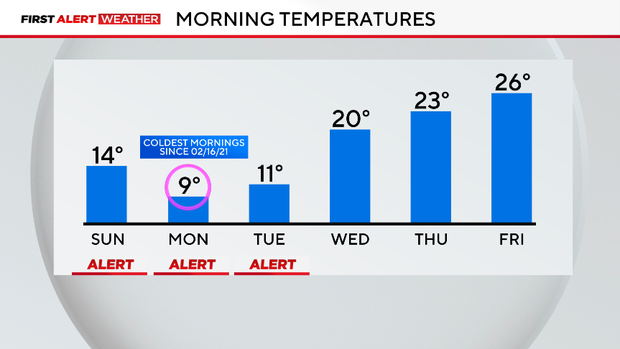
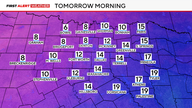
Temperatures will be dangerously cold and stay at or below freezing for 75+ hours. This could lead to issues when it comes to pipes. Be sure to winter-proof your home if you haven't already. Temperatures are expected to climb above freezing on Tuesday afternoon.
Looking ahead to next week, it will be a slow thaw with temperatures warming to the 50s by the end of the week. We are watching a system towards the end of next week, but the chances of any snow have gone down.