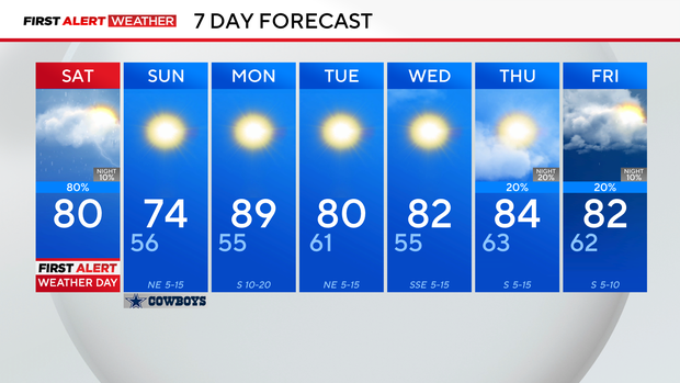
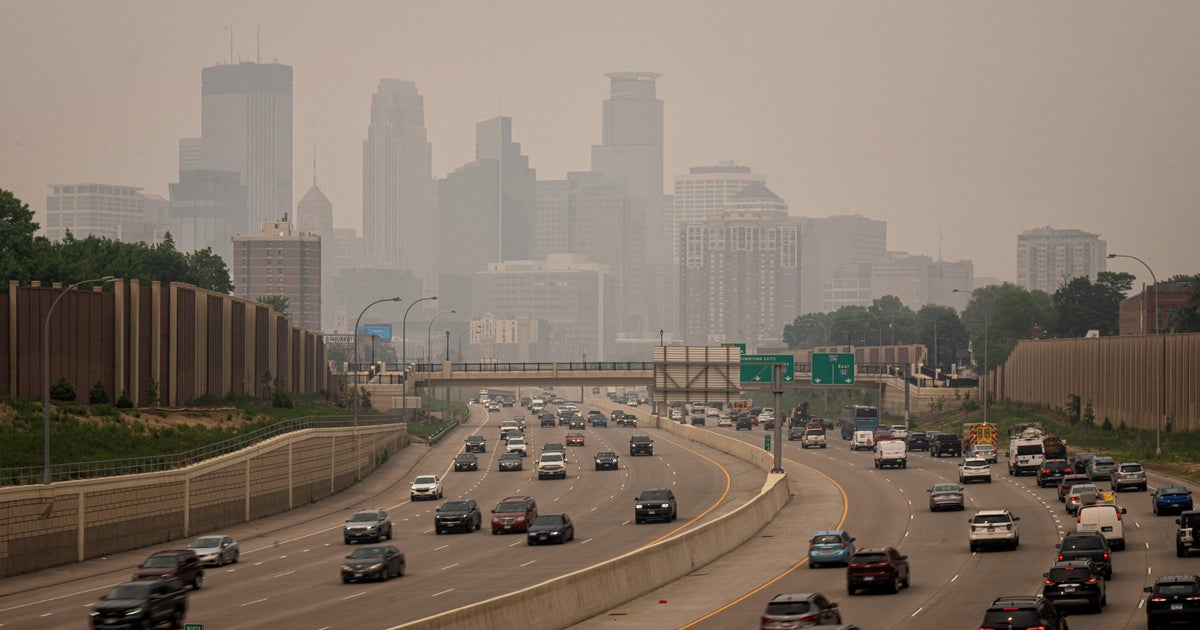
Severe weather threat returns to North Texas Saturday, bringing possible high winds and hail

It is a First Alert Weather Day across North Texas due to the threat of strong to severe storms.
A strong cold front will tap into enough instability and moisture to spark up a few isolated to scattered severe storms throughout Saturday. As a result, the Storm Prediction Center (SPC) has highlighted a marginal and scattered risk across North Texas. Wind and hail will be the primary threats, but an isolated tornado cannot be ruled out.
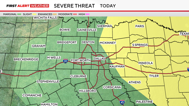
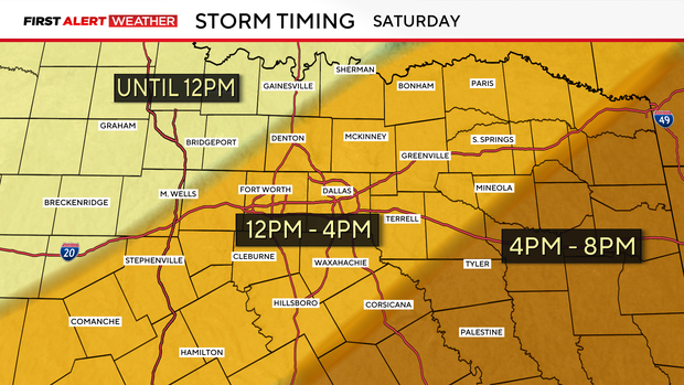
The storms are expected to move from the west to the east ahead of a cold front throughout the day, with all activity forecasted to wrap up around 8 p.m. Saturday.
The SPC is expecting some of the strongest activity to be around 11 a.m. to 1 p.m. across the DFW Metroplex.
After the front, a cooler and drier airmass will settle in across North Texas. This will allow for a nice and crisp morning on Sunday. The low is forecasted to drop to 56 degrees; it has been 158 days since temperatures have gotten this low.
Sunshine will be in the forecast all day Sunday with a wind from the north around 5- 15 mph, and the high will be around 74 degrees. Perfect weather for the last day of the State Fair of Texas.
A series of fronts will keep temperatures at bay and bring additional chances of rain next week. Be sure to stay tuned for the latest forecast updates.