Near record temperatures possible ahead of rain chances mid-week across North Texas


It's been a warm and windy day. In fact, it's so warm that the temperature at 9 a.m. reached the average high temperature for this time of year, which is 57 degrees.
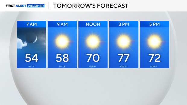
The high on Monday is expected to reach into the mid-70s with mostly sunny skies and winds gusting from the south at 25 mph.
Tuesday and Wednesday temperatures climb near record-breaking levels.
Tuesday, the morning low will be in the mid-50s and the high in the upper 70s. A weak front will move through, which will cause a wind shift from the northwest in the afternoon. Otherwise, the front will have no impact or major cool-down associated with it.
Wednesday temperatures climb into the upper 70s, which will be near the daily record high, which was 83 degrees set back in 2006. Winds from the south will pump in some moisture to the area throughout the day.
A cold front is forecast to slowly move across North Texas starting late Wednesday night.
Showers and storms are possible starting in the early morning Thursday and lingering throughout the day as the system migrates eastward. Models are currently in disagreement for reinitiating storms on Friday. Just note that there is a possibility, just no guarantee.
After the front completely pushes east, a cooler and drier air mass will encompass North Texas. Expect sunshine and cooler temperatures for the weekend.