The warming trend continues for North Texas as temperatures hit the 70s, 80s; rain chances return by weekend
Monday marked another well-above-average day in North Texas, with high temperatures in the middle 80s across the metroplex, keeping us around 25° above normal for this point in the year. Temperatures in the middle 80s are more common in mid-May.
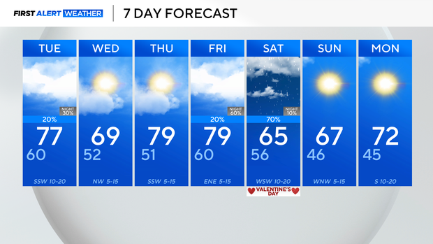
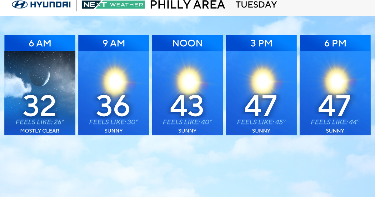
Tuesday will still be a very warm day, with lows starting near 60, and highs in the upper 70s, but we will be much cloudier throughout the day, ahead of a cold front that moves in during the evening and overnight into Wednesday.
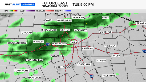
Not everyone will get a shot at this round of rain, but in the spots where showers do set up, we're looking at no more than about 1/4" at most.
The bulk of this wraps up very early Wednesday morning.
The midweek is shaping up to be dry, out ahead of a stronger weekend system, which brings us some heavier rain Friday evening and into Saturday.
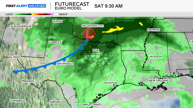
This will be a better shot at showers for the rest of the region, and unfortunately, it does look to bring a soggy start to the Valentine's Day weekend.
Expect wet weather for at least part of the day Saturday, but fortunately, the rain does look to clear up by the end of the weekend.
Sunday looks nicer, with highs dropping back to the mid-to-upper 60s behind our cold front.
From there, we warm back into the 70s to start the next week.