Cold front brings cool, windy and dry air to North Texas
North Texas had another morning of fog. It cleared late morning after slowing down the airports earlier. Highs on Sunday got into the 50s.
It's been a run of colder days in the first days of December, the coldest start to the month since 2009.
The brisk north winds and a little bit of light rain earlier come to an end Sunday evening. Skies have cleared and the temperature will drop to freezing. Expect a frosty start to your Monday under partly cloudy skies.

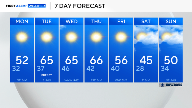
Monday stays cold with a light north wind; highs will only be in the low 50s. When winds turn to the south on Tuesday, we kick off a run of very nice winter days.
At the end of the week, another shot of cold air arrives, expect a very cold weekend.
The First Alert Weather team is watching the precipitation chances on Saturday night and Sunday to see if they develop. A few long-range models are showing the possibility. We could get some sleet if we do.