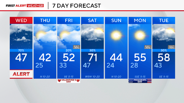
Wednesday will be cold, cloudy in North Texas after stormy morning


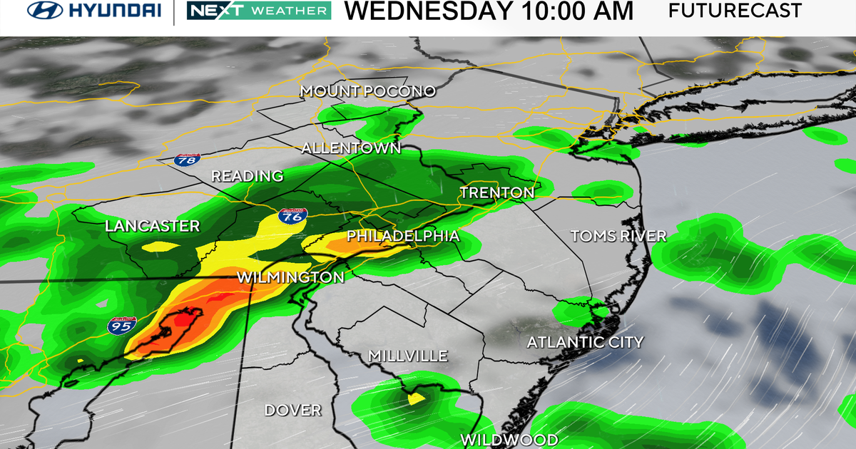
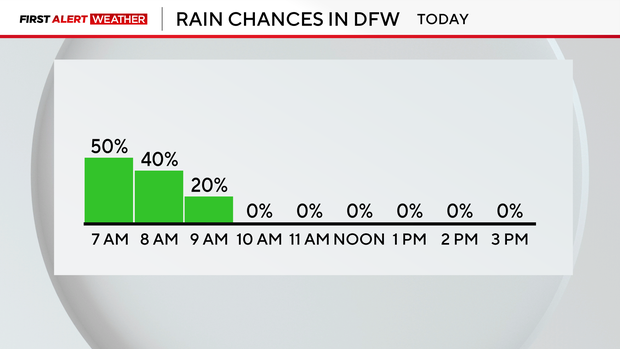
A line of thunderstorms moved across North Texas early Wednesday morning, making for a wet morning commute.
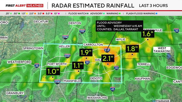
The storms were strong with winds gusting to near 30 mph. BB-sized hail was reported with these thunderstorms.
The heavy rain also impacted North Texas and in parts of the Dallas-Fort Worth Metroplex, there was between 1"-3" of rain in a short amount of time leading to a flood advisory for Tarrant and Dallas counties.
The storms moved east quickly, moving out of the Dallas-Fort Worth Metroplex around 6:30 a.m.
Rain tapered out by the end of the morning commute and North Texas will remain dry the rest of the day. The high temperature on Wednesday will only warm to the mid-40s across DFW but some spots will only warm to the upper 30s due to strong cold air.
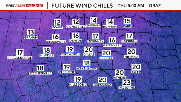
Colder air will be in place by Thursday morning, with air temperatures in the 20s, but "feels-like" temperatures in the teens. Highs on Thursday look to top out in the lower 40s.
By Friday, Valentine's Day, there will be a mix of sun and clouds with highs warming back to the middle 50s.
There will be a series of cold fronts in the forecast with the first one moving through North Texas on Wednesday before another cold front this weekend blasts through. Then another cold front is on the way next Tuesday into Wednesday.
While the weekend starts out a bit soggy on Saturday morning, the clouds will clear and the sunshine will be in full force for Saturday afternoon into Sunday and Monday.