Pittsburgh Weather: Sunshine Returns On Monday And Warmer Temperatures Expected This Week
PITTSBURGH (KDKA) - After a sunny but cool, breezy Sunday we'll watch clouds return tonight as a cold front swings by our region.
Aware:
- Areas far to our north could see a few snow showers flurries tonight mainly north of I-80.
- Looks like they may let the flood advisory for the Ohio River at Pittsburgh/Allegheny Co. expire at 7pm tonight. River crested this morning and is falling. Mon Wharf still flooded and closed.
Alert: None
WEATHER LINKS:
Current Conditions | School Delays & Closings | Local Radar | Weather App | Photos
That will bring a chance of a few snow showers far north, mainly north of I-80, tonight but mainly nothing but a few clouds for most of us.
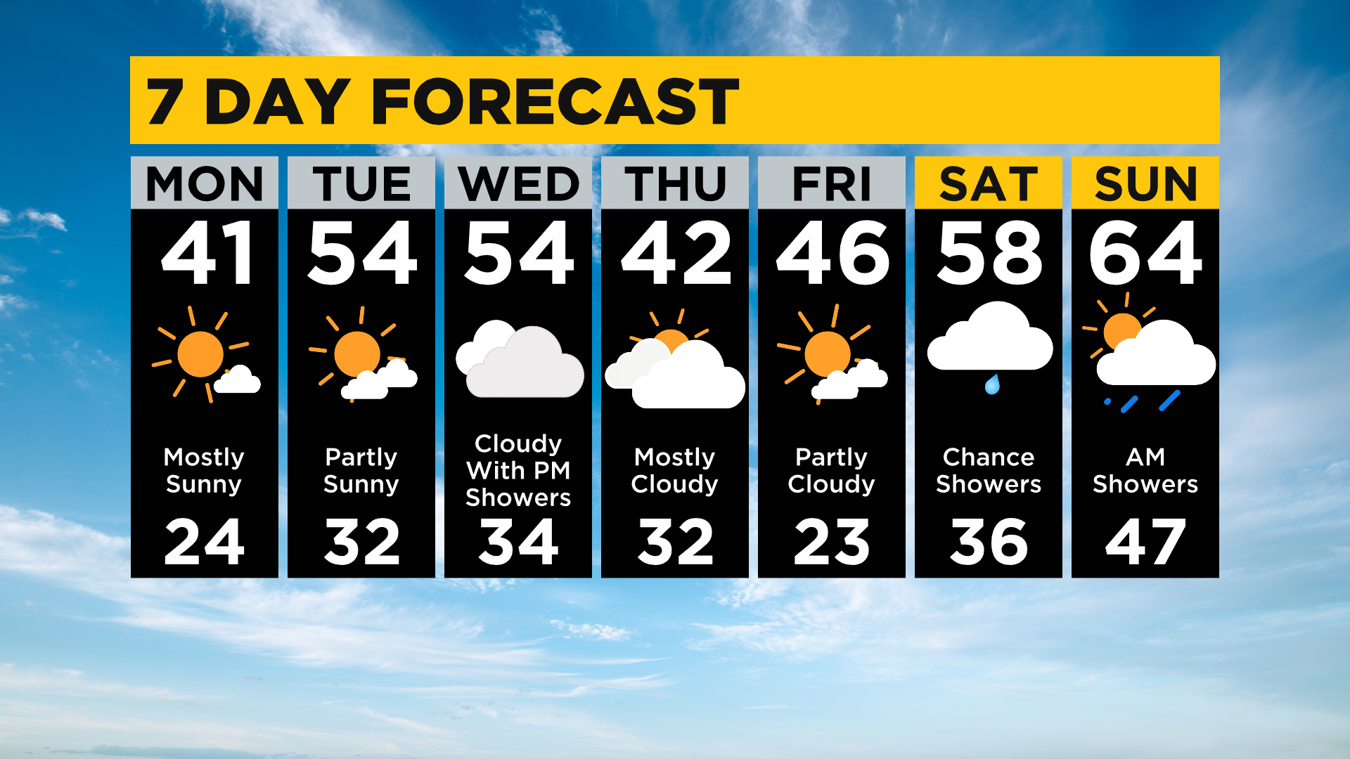
Those of you in Clarion, Mercer, Venango, and Jefferson counties could see a flurry or brief snow shower later tonight. Once the front passes, skies will clear and the winds will die down but temperatures will bottom out in the lower to mid-20s again tonight.
Sunshine returns Monday with highs in the lower 40s (seasonable for the last day of February)!
Temps then warm mid-week with highs in the 50s and a chance for a few rain showers Wednesday night. We could flirty with 60 degrees by the weekend!
Stay up to date with the KDKA app, which you can download here.