Rain returns to the Pittsburgh area on Friday, cooler temperatures ahead

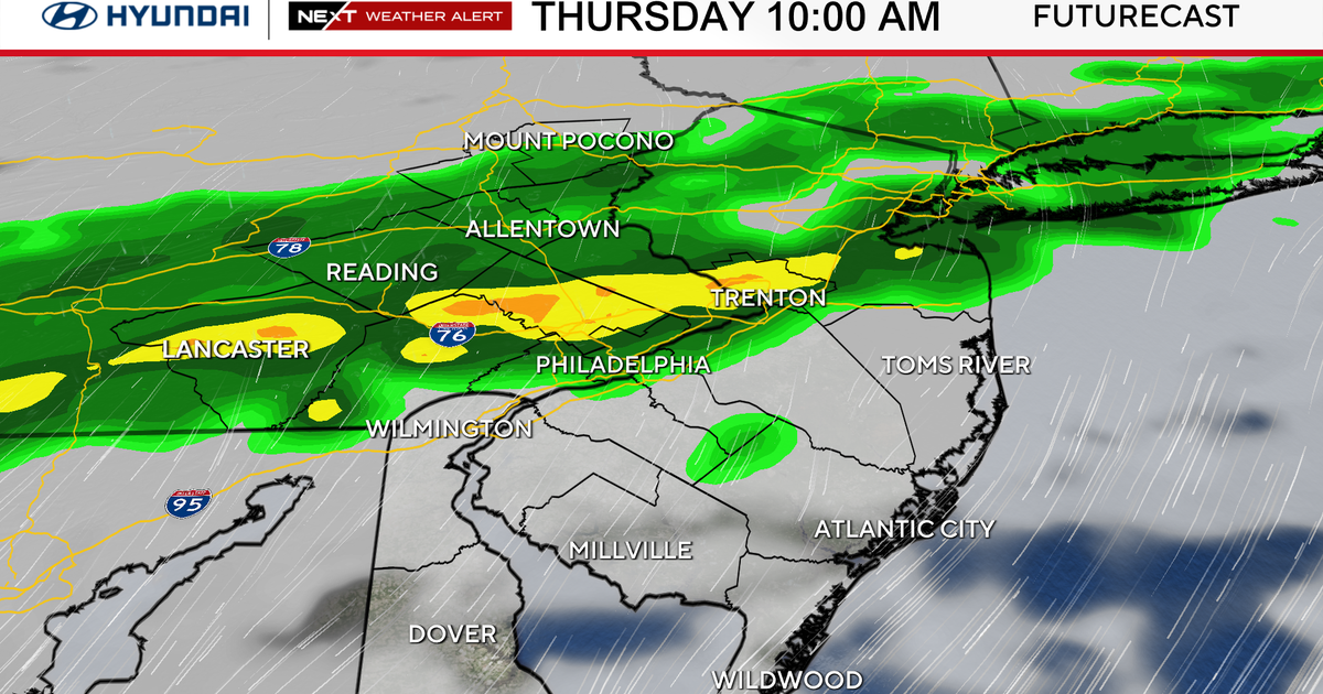
While many are talking about just how warm we were yesterday, the top weather story today is the return of rain. I have us seeing two rounds of rain today, with just an isolated chance for rain between the two rounds.
WEATHER LINKS:
Current Conditions | School Closings & Delays | Submit Your Weather Photos
The first round of rain will be the lighter of the two and will occur from around 7 a.m. through 1 p.m. Rain at this time will be scattered, meaning not everyone will see it.
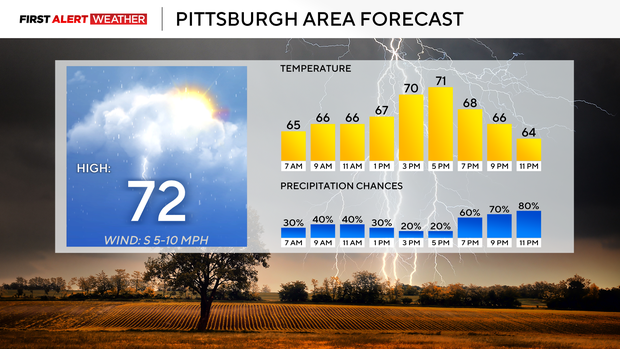
The second round of rain will come in maybe as soon as 6 p.m., but probably won't arrive until after the sun sets. Rain tonight will continue through sunrise tomorrow. Drizzle will be possible for the rest of the morning. Highs today will struggle to get back up to around 70 degrees. Most of the day will see temperatures in the mid-60s.
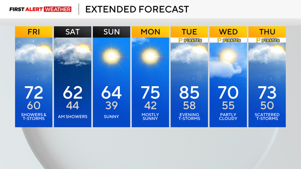
Saturday's high will likely be hit at midnight, with temperatures in the 50s for the rest of the day. Skies are clear late Saturday with temperatures dipping to the 30s on Sunday morning.
Frost advisories are likely for some areas due to the cold weather. Sunday highs should get back to the mid-60s. Looking ahead, highs return to the 70s on Monday and the 80s on Tuesday. There will be a storm chance on Tuesday afternoon.
Yesterday was the second day this April when we have seen highs hit 85° or higher. You'd have to go back to 2010 for the last time we did that.
Over the past week, we have seen two days with highs jumping to the mid-80s. Last Saturday, we saw a high of 86°. Yesterday's high hit 85°. It is rare to hit 85° or higher in April in Pittsburgh. Most years, we don't see any actually. The most 85° or higher days we have ever seen were four, set in 2009 and 1990. It's fairly rare to get this hot this quickly in the year, but it does happen.
Does this mean we should be ready for a hot summer? Maybe.
In my experience, though, hot spells don't stick around that long as favorable atmospheric conditions change. Basically, we are sitting in optimum "heat" conditions right now. Things will change as we go into the summer months. It doesn't mean we won't be above average when it comes to our temperatures; that's pretty much a given at this point. What it means is that I don't expect us to see so many outlier stretches that are top 10 or top five on record days when it comes to how hot we are.
Stay up to date with the KDKA Mobile App – which you can download here!