Tornado watch for Pittsburgh area expires after severe storms roll through
A tornado watch for parts of the Pittsburgh area has since expired after severe weather rolled through the area on Wednesday.
Pittsburgh and counties south of the city were under a tornado watch, and tornado warnings were issued for parts of Allegheny, Washington and Greene counties, but all those have expired. It looks like the worst is over, though rain will continue.
The National Weather Service's Storm Prediction Center had all of western Pennsylvania, eastern Ohio and the West Virginia panhandle included in an area of the country under a "slight" risk for severe weather that is graded as a level two on a scale of one to five.
The National Weather Service said that a slight risk on the scale means there is increased confidence in severe storms occurring and that "a few severe storms could be significant."
When will it storm in Pittsburgh?
Storms moved through this morning, and skies are gradually clearing for areas near and south of the I-70 corridor, which will contribute to more heating and destabilization of the atmosphere. That will likely be the focal point for any enhanced severe thunderstorm activity during the afternoon and evening hours, though it could wobble north some.
While severe storms can occur at any time, including during the morning hours, the highest chance for severe weather will come from around 2 p.m. through 11 p.m. Wednesday. The actual cold front storms are expected around 9 p.m. to 11 p.m.
Storms could bring tornadoes to Pittsburgh area
Cells that remain discrete will have the greatest potential to rotate and produce tornadoes. If a tornado happened, the maximum intensity would most likely be in the EF-1 to EF-2 range.
Damaging wind gusts from microbursts and downbursts are our greatest threat, along with hail. This entire event should be completed by later this evening, between 10 p.m. and midnight, once the cold front clears the area.
Excessive rain also possible
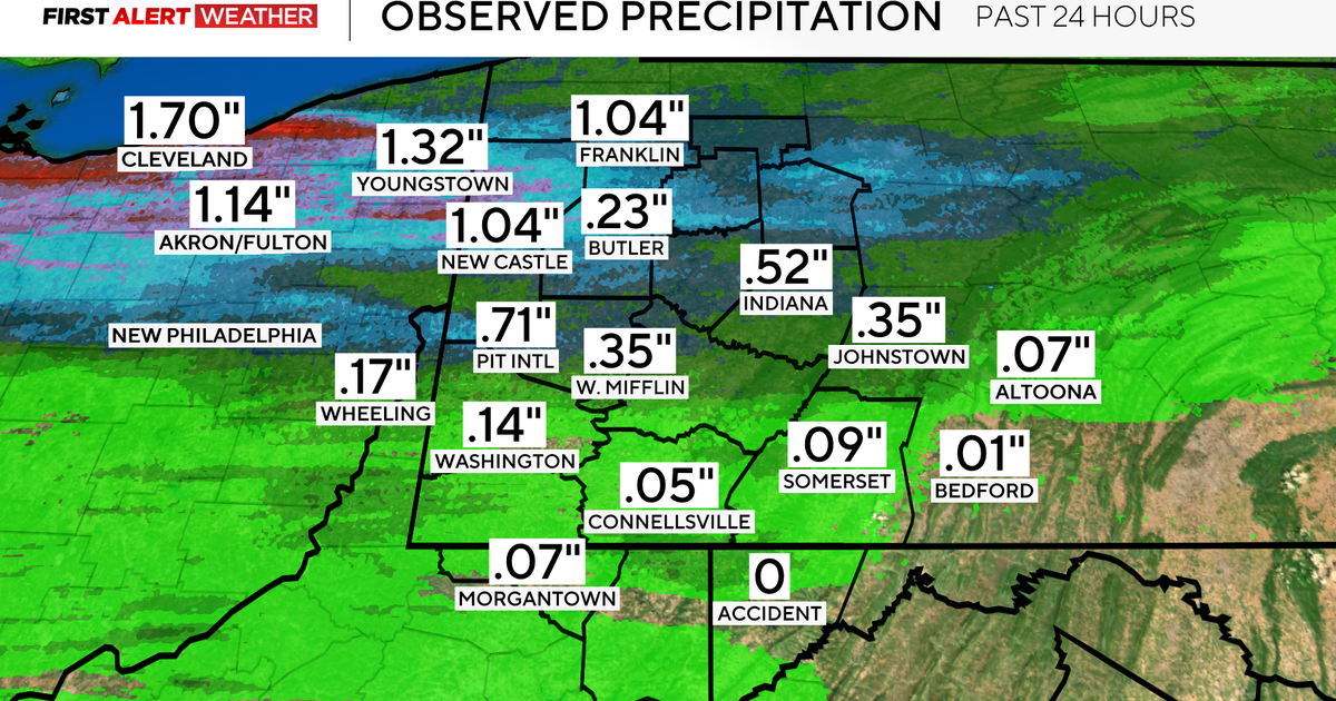
In addition to the severe weather chances being possible for the area, the National Weather Service said there is also a marginal risk of excessive rainfall.
"While a Flood Watch won't be needed, there still may be some minor flooding issues in flood prone areas," the NWS said.
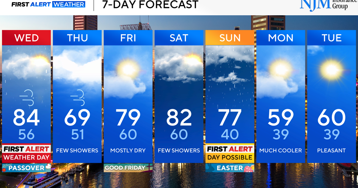
With the threat of severe weather hitting the Pittsburgh area, the KDKA Weather team has issued a First Alert Weather Day, reminding people to be weather aware.