Temperatures cool off on Easter Sunday in Pittsburgh with some areas looking at Monday storms
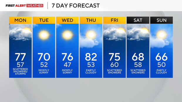
A gorgeous end to the weekend gives way to warmer air again on Monday, along with increasing clouds.
First Alert: None
Aware: Possible gusty showers/storms Monday afternoon (mainly 2-6 p.m.).
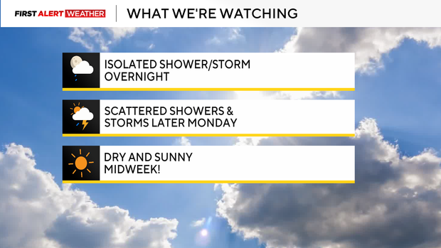
An overnight shower or isolated storm is possible late Sunday night with a warm front lifting north through the region. We get a bit of a lull mid-morning to early afternoon Monday, but an approaching cold front could touch off another line of potentially gusty storms Monday afternoon into early evening.
The best timing would be between 2-6 p.m. on Monday.
A few storms could contain strong wind gusts.
Tuesday brings a return to sunshine that lasts through midweek, along with above-normal temperatures in the upper 60s and lower 70s.
Our next rain chance looks to hold off until late Thursday night into Friday.
WEATHER LINKS:
Current Conditions | School Closings & Delays | Submit Your Weather Photos


