WEATHER BLOG: Another Shot At Snow!
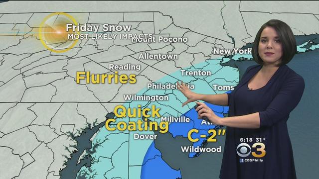
It may not be long before the Philadelphia region sees some more snow.
Watch CBS News
It may not be long before the Philadelphia region sees some more snow.

After a strong arctic cold front pulled through the region on Tuesday afternoon, frigid air will remain settled over the region for the next 4 to 5 days as high temperatures remain below average and even below 40° during the afternoon hours until the second half of the weekend when we finally rebound a small amount.

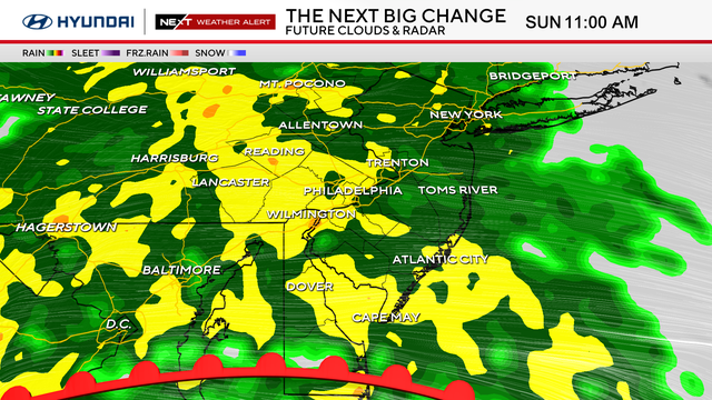
Multiple low pressure systems are set to move through the region starting today with a potent cold front that should sweep across the Philly region in the early part of the afternoon.

The bulk of the accumulation will likely occur Saturday afternoon.

Winds like we are dealing with Sunday can make driving very difficult, especially for high-profile vehicles.

So how much snow will fall in the Philadelphia area this winter?

Most of the rain for Thursday happening before the daylight hours of the morning, but a few lingering areas of scattered showers are likely as we move throughout the afternoon.

The month of October is usually filled with thoughts of hot cider and pumpkin patches and Halloween night where you need to wear a sweatshirt under your costume.

A cold front tried to make its way across the region on Thursday afternoon and it did manage to spawn a couple of rain showers here and there through the night but overall the front stayed just to the north of Philadelphia.

The Atlantic Hurricane Season officially runs from June 1 to November 30, but usually as we head into the month of October we start to turn our attention away from the tropics and start to focus on long-range forecasts for the winter time.

As we progress through the first full week of the month of October, many of us start to look for signs of cooler temperatures and Fall conditions.

Our lovely stretch of Fall weather continues Friday and into the coming weekend as well, so make sure you are keeping the jackets handy at times.

For the first time in about a week, temperatures are going to be back on the cooler side of things as a more Fall-like pattern sets up over the Delaware Valley.

After starting out the month of September on a nice cool Fall-like note, we had a dose of Summer time heat to start out the actual Fall Season for the just about the last week or so.

As we all know Fall officially started last Friday afternoon, but since the second half of last week, we have felt anything but Fall-Like.

It will be a warm start to the Fall season as we look for temperatures at times this weekend to push up near 90 degrees!

Hurricane Jose, a Category 1 storm on the Saffir-Simpson Scale, continues its trek to the north in the open waters of the Atlantic Ocean.

Currently Jose should regain its hurricane force strength by the end of the day on Friday.

Hurricane Irma continues to tear through the Caribbean, leaving death and destruction in its wake, and the latest forecast path of the storm means dangerous news for the state of Florida.

Great viewing conditions overnight for a peek at the Perseids!

Low pressure is forecasted to sweep across the region today spawning rain and thunderstorms all day long.

High temperatures across the Philadelphia portion of the I-95 corridor are once more going to climb into the middle or upper 90s Friday afternoon.

An Excessive Heat Warning, as well as Heat Advisory, goes into effect at Noon Thursday. It will last until Friday at 8 p.m.

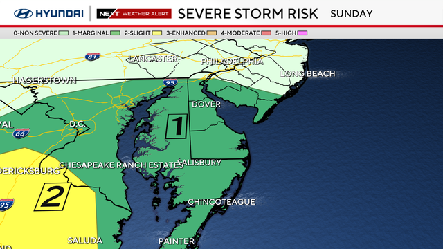
All of the Delaware Valley is under either a Slight or Marginal Risk for Severe Weather today.

The heat peaks Thursday with a record challenging 96-degree high in Philadelphia.