Wet weather clearing Tuesday in Philadelphia region before more overnight rain
PHILADELPHIA (CBS) -- The week ahead in the Philadelphia region slips into a somewhat unsettled pattern.
There will be several rounds of rain through Thursday night as well as very high humidity levels with dew points in the 70s -- meaning there will be lots of available moisture for these storms to work with.
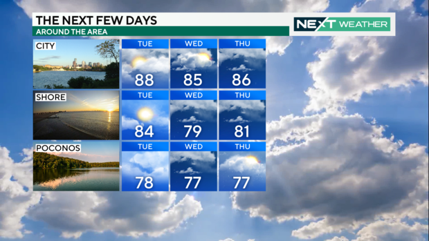
After some overnight precipitation, the chance for rain will taper off a bit for a good portion of the day on Tuesday.
Late Tuesday night and into Wednesday, rain will return and bring a chance of early-morning downpours Wednesday.
While it won't rain all day, locally heavy showers are likely in spots through Thursday. That's when we'll have the best chance for rain ahead of a cold front that will sweep across the Northeast Thursday afternoon into Thursday night.
By Friday morning, the front looks to push off to the east, bringing a close to the rainy pattern and giving way to plenty of sunshine for the weekend. We just have to get through a somewhat rainy week before then.
Here's your 7-day forecast:
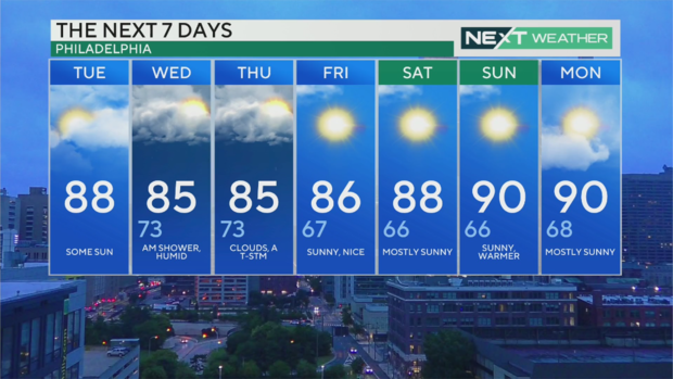
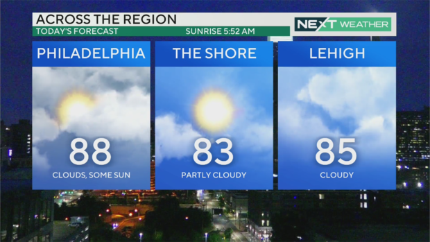
Tuesday: High of 88, low of 71, isolated thunderstorm
Wednesday: High of 85, low of 73, scattered storms
Thursday: High of 85, low of 73, scattered storms
Friday: High of 86, low of 67, clearing
Saturday: High of 88, low of 66, mostly sunny
Sunday: High of 90, low of 66, mostly sunny
Monday: High of 90, low of 68, mostly sunny


