NEXT Weather: Saturday P.M. rain chances, warmth returns Sunday
PHILADELPHIA (CBS) -- We could have a wet Saturday afternoon and evening, so it's best to be prepared: carry your umbrella with you today.
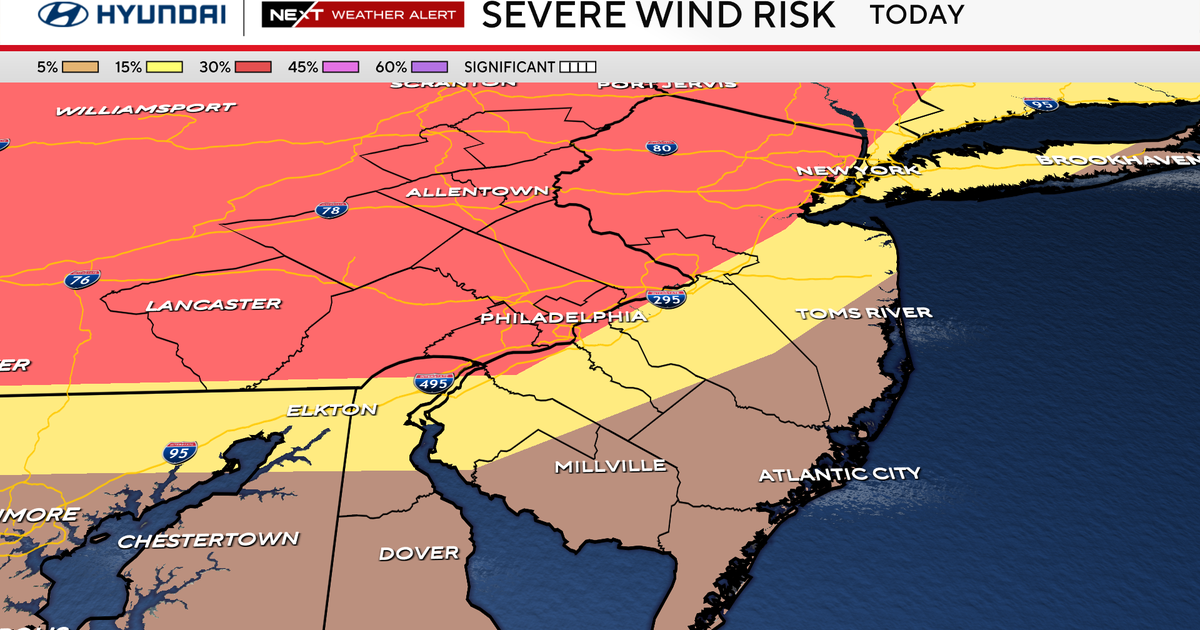
Storms intensified over the Lehigh Valley in the early afternoon, leading to multiple weather alerts.
These may pop-up periodically this afternoon.
There are also a few areal flood advisories due to locally heavy downpours and localized flooding.
A Flash Flood Warning was issued for Lehigh and Northampton counties until 5:30 p.m.
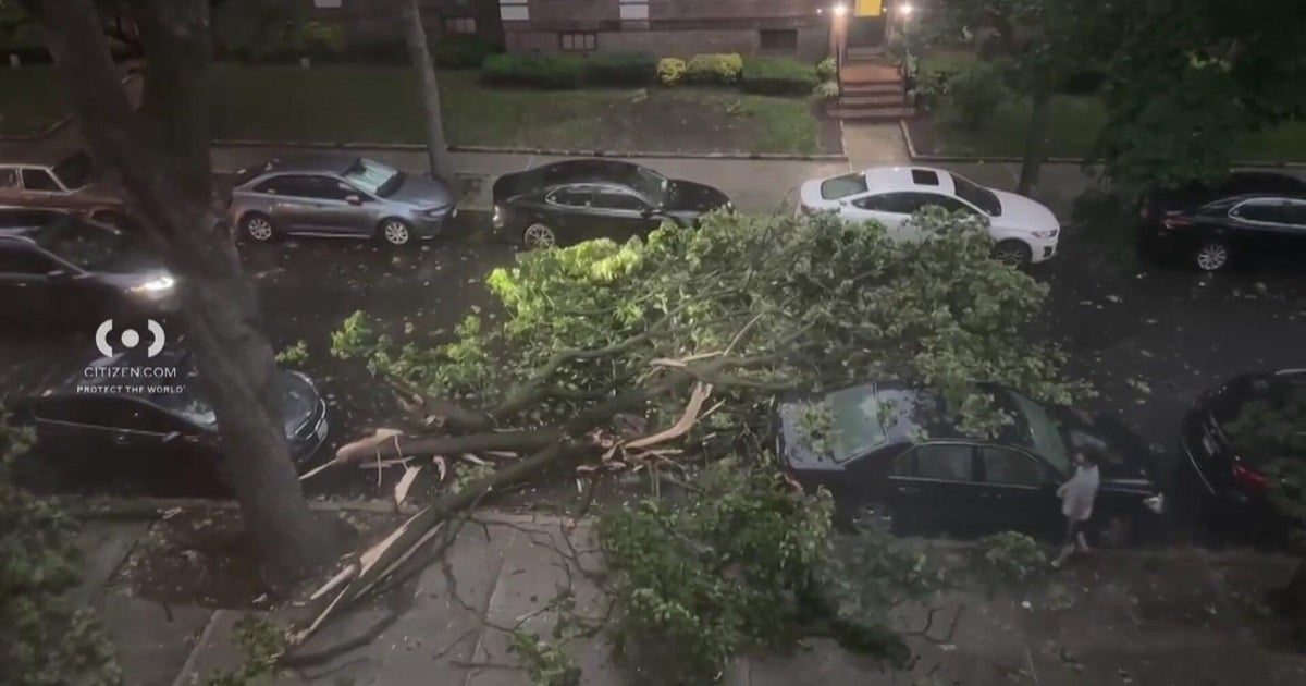
A downburst of damaging wind could occur but hail and downpours are the main threat.
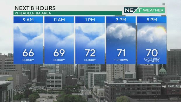
Around the area, we're dealing with clouds, and there is a marine fog advisory along the coasts.
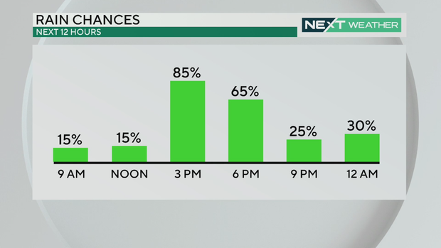
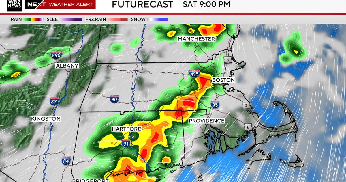
Showers really get going after noon, with the steadiest rain in the mid afternoon and into the evening, and then rain tapers off quickly.
Any storms are not expected to be severe but small hail and brief downpours may accompany any storm.
After 8 p.m., we should see showers move out before a cloudy night.
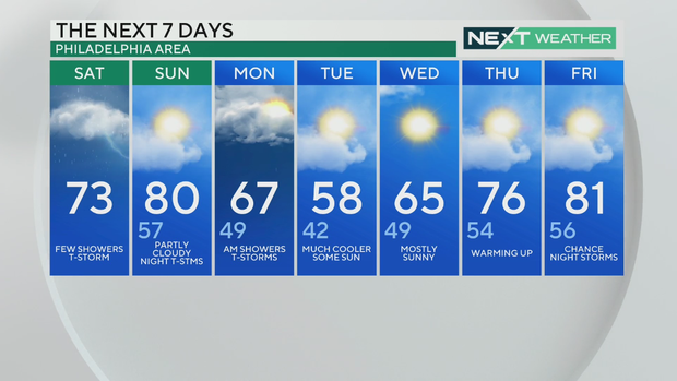
We could see fog on Sunday morning and rain on Monday.
Not the last of the April 80s!
We set multiple temperature records around the region this week. On Friday, we saw record highs in Allentown, Pa. (88, beating the old record of 87) and Mount Pocono (84, beating the old record of 82).
And there were record warmest low temperatures at the Atlantic City Airport (63 degrees, previous warmest low was 60) and Atlantic City Marina (60 degrees, previous warmest low was 58) in New Jersey.
We could hit 80 again on Sunday. It's should be partly cloudy in the day but we could see evening thunderstorms.