Cloudy and cool Tuesday weather in Philadelphia region, showers return through midweek

PHILADELPHIA (CBS) -- After a lot of sunshine Monday, cloud cover has returned and that will help keep temperatures on the cooler side once again for Tuesday's weather in the Philadelphia area.
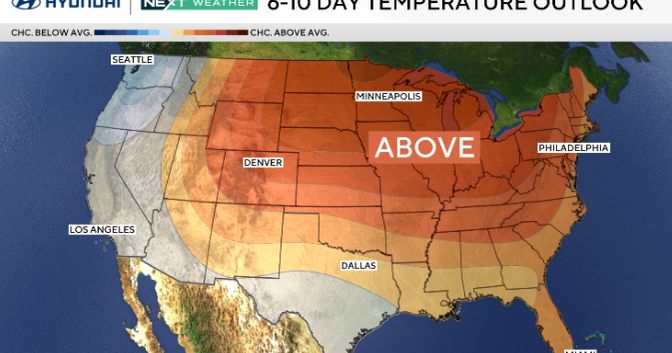
A storm system over the Midwest combined with a large low pressure system over the Atlantic Ocean will bring mostly cloudy skies to the Philadelphia area Tuesday. High pressure centered over the Canadian Maritimes will provide relatively dry and stable conditions at the surface which will keep rain away from the region for now.

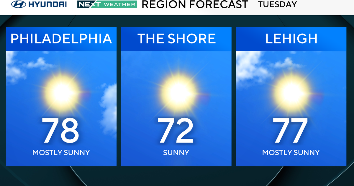
Temperatures, however, will only climb into the low 50s across the Delaware Valley thanks to the cloud cover and flow out of the northeast. Conditions along the shore will be a little cooler with highs in the upper 40s, but most of the area should climb out of the 40s and into the low 50s, which is still about five degrees cooler than normal.
A storm system currently over the Midwest will advance east today and begin to shift our flow out of the southwest overnight Tuesday into Wednesday morning.
This increasing moisture ahead of an approaching cold front will result in areas of fog and light sprinkles early Wednesday morning. That said, temperatures will be a little warmer thanks to the southwest flow with lows in the middle 40s.

The chance of rain will increase into Wednesday afternoon with scattered showers expected as temperatures warm into the upper 50s.

The cold front will push east of the region Wednesday night, but an area of low pressure over the Southeast will track north and begin to spread the chance of showers back over the region into the day on Thursday.

Weather for Phillies home opener on Thursday, March 28 vs. Braves: will it rain?
There remains some discrepancy in the forecast models for Thursday with just how far to the west the area of showers will develop due to this coastal low pressure system.

Right now there is about a 60% chance for rain across the Philadelphia area Thursday afternoon and that could be an issue for the Phillies Home Opener, which is set to start at 3:05 p.m.

Eventually the storm system will track to the northeast and give way to clearing conditions for Friday with temperatures expected in the middle 50s.
A fast-moving clipper system is expected to move through the area Saturday which may bring a few showers to the area, but right now Easter Sunday looks dry with high temperatures around 60 degrees.
Here's your 7-day forecast:

Tuesday: Mostly cloudy. High 51
Wednesday: Scattered showers. High 58, Low 44
Thursday: Tracking rain that could impact Phillies home opener. HIgh 55, Low 47
Friday: Clearing, breezy. High 55, Low 38
Saturday: Mainly dry. High 60, Low 38
Sunday: Partly sunny. High 59, Low 42
Monday: Shower late. High 58, Low 40
Get the latest weather info on the CBS News Philadelphia app.