Tracking rain, stormy weather chances after sunny start to Memorial Day Weekend at Jersey Shore, in Philadelphia

PHILADELPHIA (CBS) -- Almost ideal weather conditions will start off the Memorial Day weekend around Philadelphia and the Jersey Shore, but there could be some severe storms Monday.
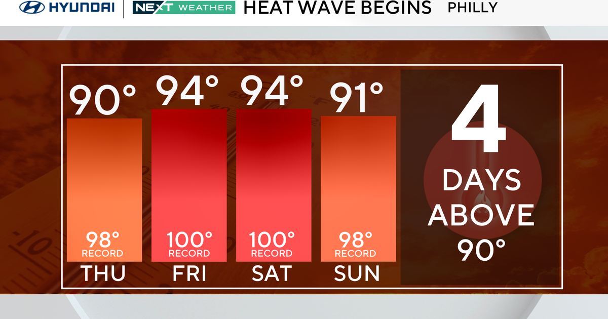
After a couple days with a fair amount of sunshine and temperatures in the 80s across much of the area, Monday will bring a dramatic change from the sunshine we're expecting the rest of Memorial Day Weekend.
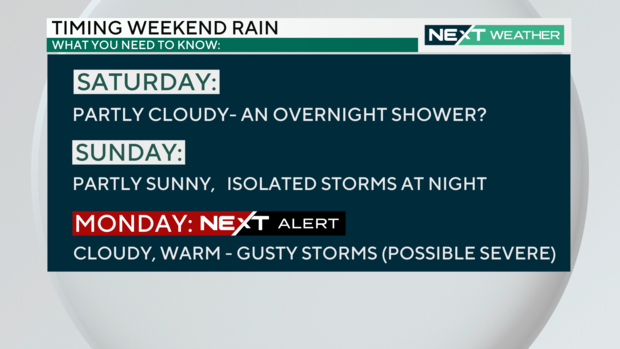
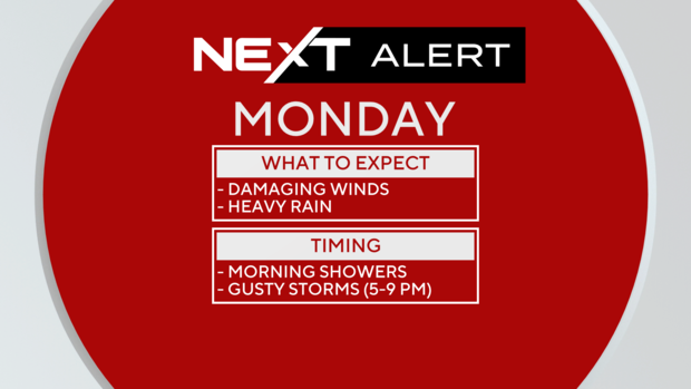
Ahead of the storms that are expected on Monday, the CBS Philadelphia NEXT Weather Team has issued a NEXT Weather Alert for Memorial Day due to the threat for some of the stronger storms producing damaging winds in addition to periods of heavy rain.
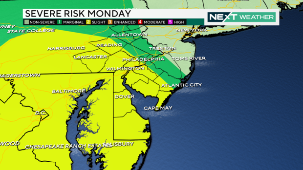
The Storm Prediction Center has already put the southwestern part of the Philadelphia region in a "Slight" risk for severe weather which is level 2 on the 0-5 scale. The affected area includes Gloucester, Salem, Cumberland and Cape May counties in New Jersey; all of Delaware; and counties west and northwest of Philadelphia including Chester, Delaware, Berks and Lancaster.
Other areas like Montgomery and Bucks counties and the Lehigh Valley in Pennsylvania and Camden, Burlington and Atlantic counties in New Jersey are under a "marginal" risk for severe weather, or level 1 on the 0-5 scale.
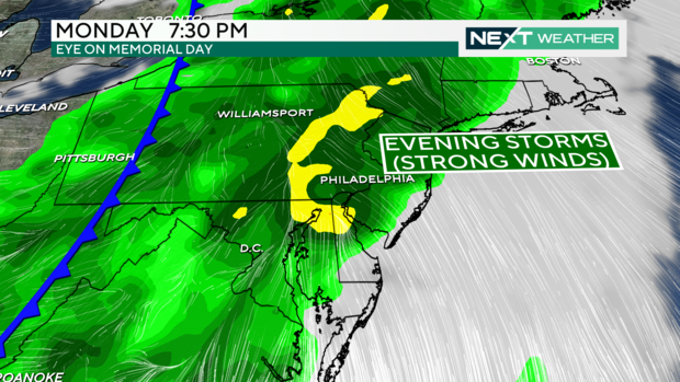
Some scattered showers will be possible Monday morning, but the stronger line of storms is not expected until later Monday evening as a cold front begins to swing through from the west.
The primary concern with the storms that move across the region Monday evening will be strong to damaging winds, but the heavy rain associated with these storms may also result in some flooding.
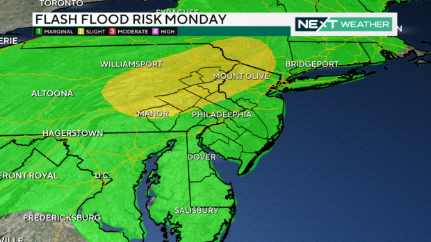
Areas to the north of Philadelphia – including the Lehigh Valley, Berks County and Upper Montgomery County – are also under a "Slight" risk for excessive rainfall that could be enough to result in some flash flooding. Rainfall totals could range between 1 to 2 inches with some locations potentially receiving a little more than that.
The storms will come to an end Monday night as the cold front sweeps through the region and right now the forecast shows more sunshine for Tuesday with high temperatures near 80 degrees.
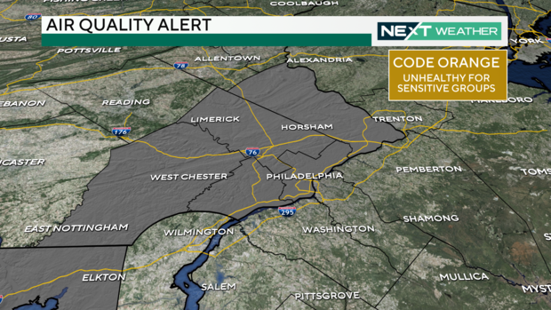
Air quality alert in Philadelphia for May 25, 2024
Philadelphia and many nearby counties are under a Code Orange air quality alert on Saturday, May 25, 2024 due to potentially higher levels of ozone. Code Orange means the air quality may be unhealthy for sensitive groups such as people with asthma or other lung conditions should limit the amount of time and strenuous activity outside.
There may be times during the day when the air quality is OK for outdoor activities. You can keep up with the current air quality conditions in Philadelphia at Airnow.gov.