Hurricane Erin brings rip current, beach erosion risks to New Jersey, Delaware beaches. Here's the forecast.
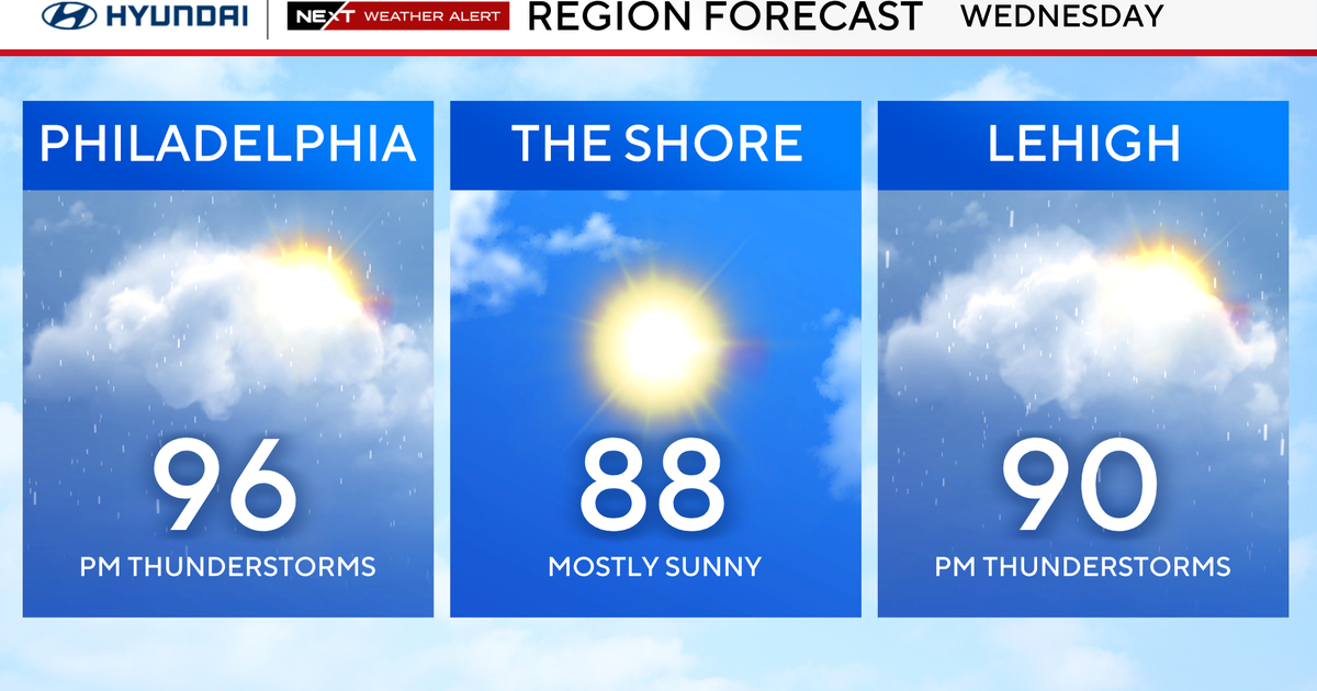
Philadelphia's weather on Wednesday will be cloudy and feature some scattered showers — and even potentially thunderstorms — not connected to Hurricane Erin.
We're seeing some rain in the early morning and another round of precipitation could pop up in the mid-afternoon.
At this point, the Storm Prediction Center has the region under a general thunderstorm risk, meaning storms are possible but severe weather looks unlikely.
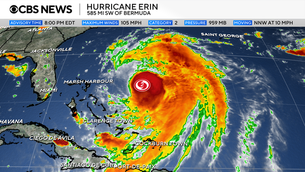
Meanwhile, Erin continues its northerly track and will deliver impacts here in the Philadelphia region, mainly at the shore.
While the heart of the storm will likely stay well offshore (fortunately), we will have several impacts locally, especially along the Jersey Shore and Delaware beaches. These impacts will peak Wednesday and Thursday. Here's what to know:
- High rip current risk will continue through at least Friday
- Long period swells will generate rough surf and large breaking waves
- 8-12 foot seas on Wednesday that could build as high as 10-15 feet Thursday
- Dangerous swimming and boating conditions all week
- Beach erosion and coastal flooding are likely. There's already a coastal flood advisory for the Jersey Shore and Delaware in place on Tuesday.
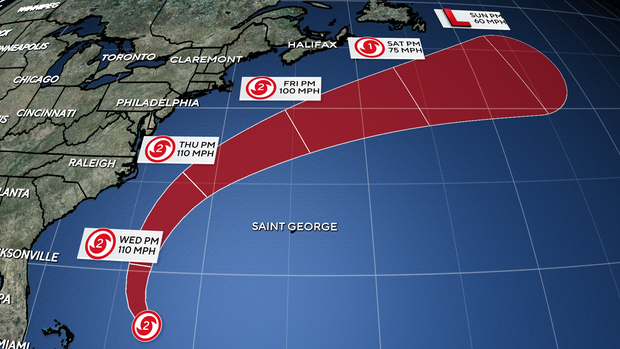
In addition, the wind gusts will likely peak on Thursday with gusts as high as 50 mph from the east, possibly adding to the potential for beach erosion and flooding.
Several beach towns have banned swimming this week due to the rough surf, high waves and potential for dangerous rip currents. Some bans are in effect through Thursday while others are indefinite until local beach patrol sees conditions improve.
Away from the coast, impacts from Erin will be limited. The bigger story will be the cool and cloudy pattern that we'll be stuck in through at least the first half of the week — highs only in the 70s with limited sun and the chance for spotty showers. A cool breeze will make it feel more like fall than August. We'll start to brighten up and warm up by the end of the week, into the weekend as Erin moves away.
Heading into the weekend, Friday and Saturday are looking a bit warmer with highs in the 80s under sunny skies, with the possibility of more storms Sunday.
List of beaches with no swimming advisories or restrictions due to Erin
Jersey Shore
- Margate
- Brigantine
- Strathmere/Upper Township
- Ventnor City
- Longport
- Wildwood
- Cape May
- Sea Isle City
- Ocean City
- Cape May City
- Stone Harbor
- Atlantic City
Delaware beaches
Here's your 7-day forecast:

Wednesday: Clouds, showers. High 80, Low 66.
Thursday: Partly sunny. High 73, Low 66.
Friday: Sunny. High 82, Low 61.
Saturday: Sunny. High 82, Low 61.
Sunday: Stray shower. High 81, Low 67.
Monday: Mostly sunny. High 81, Low 68.
Tuesday: Partly cloudy. High 79, Low 63.