High wind, ice concerns in Tri-State Area after winter storm. Here's who got the most snow.
Freezing rain, ice and wind were the main weather concerns Sunday in the Tri-State Area after a winter storm hit the Tri-State Area on Saturday, the region's fourth winter storm in a week.
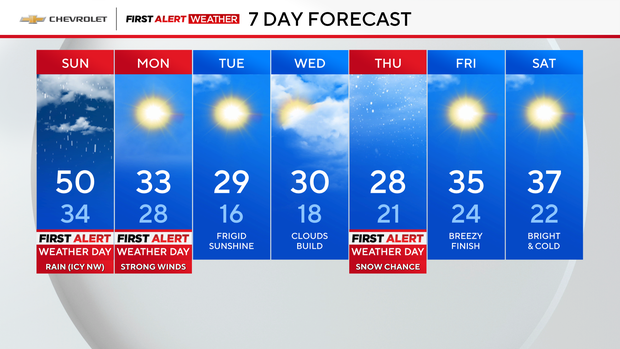
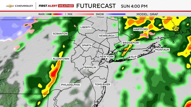
Sunday was a First Alert Weather Day due to significant icing concerns, heavy rain at times and potentially damaging wind gusts in New York, New Jersey and Connecticut.
The rain was expected to exit the area by 8 p.m., but winds were to then pick up.
Alerts and advisories
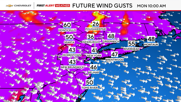
A high wind warning is in effect for most of New Jersey through Monday evening, while everywhere else is under a wind advisory.
Monday will be another First Alert Weather Day, since the strongest winds could prove damaging. With gusts between 40-60 mph, downed trees and power outages are certainly possible.
Significant icing concerns
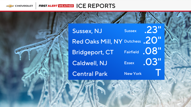
Freezing rain was the major concern in the northwest suburbs Sunday morning, most notable in Sullivan and Ulster counties, and especially in valley locations where cold air tends to get trapped.
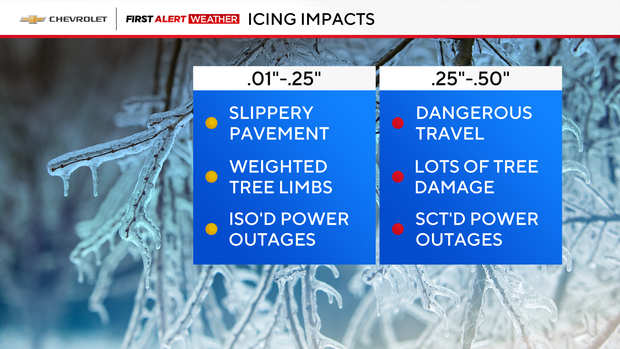
Icing could be significant, as forecast models indicated .25-.5 inches of ice accretion. With ice totals like that, there is an elevated risk for downed trees and powerlines. Trees weakened by the ongoing drought would be most susceptible to damage.
Flight delays
How much snow did the Tri-State Area get Saturday?
Up to 4.5 inches of snow fell in parts of the Tri-State Area during the winter storm, mainly in the northwestern regions. West Shokan, in Ulster County, New York recorded the most snow, while parts of Connecticut and New Jersey were spared.
West Shokan was up to 4.5 inches, but Central Park in New York City recorded just .5 inches.
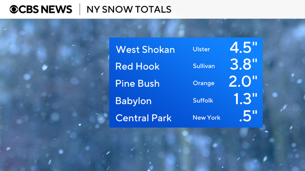
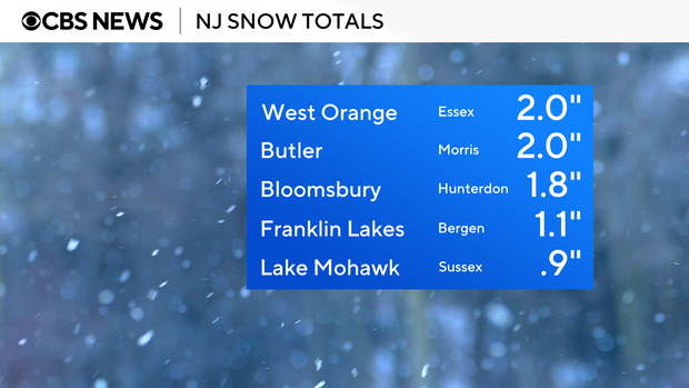
In New Jersey, 2 inches fell in West Orange. But further north, less than an inch fell in Lake Mohawk.
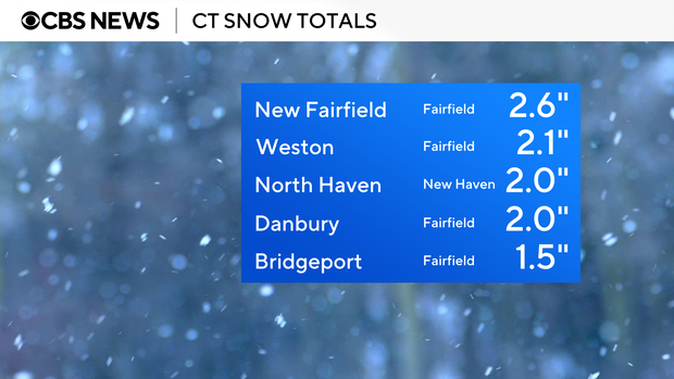
In Connecticut, New Fairfield picked up 2.6 inches and Bridgeport registered 1.5 inches.
Bigger storm this week?
The threat of another winter storm looms Wednesday into Thursday, but there is some uncertainty regarding snow totals and exactly where the storm will hit.
All models have the storm, but the exact track remains uncertain. As of Sunday, placement is a bit farther south/east, but the storm could wobble for the next couple of days.
An accumulation of 6-plus inches of snow is on the table, but so is a smaller glancing blow. It will take another 24-36 hours to iron out the details. Stay tuned!