New York-area could see record highs with summerlike weather this week
Parts of the New York area could see record high temperatures during a summerlike stretch of weather this week.
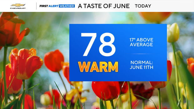
Tri-State Area residents are getting a taste of June with sunshine throughout the week.
What is the weather today?
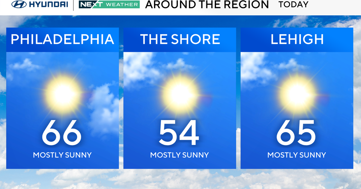
It's a quiet start to the day, with cool, comfortable air in the morning. Early temperatures are in the 40s to around 50 degrees, making it feel comfortable for the commute. By lunchtime, many spots are already pushing close to 70 degrees.
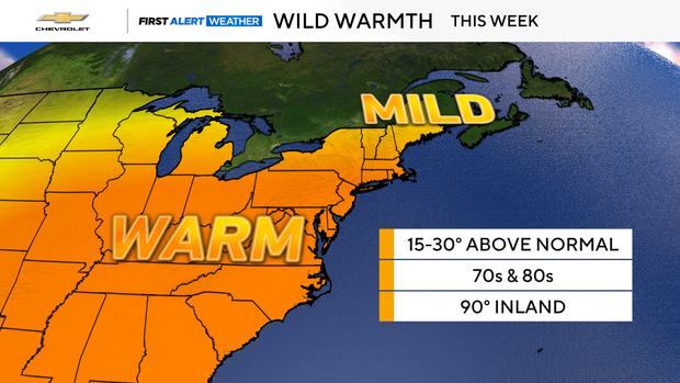
The afternoon feels like a completely different season. Warm air surges in on winds, with gusts ranging from 25 to as high as 40 miles per hour.
High temperatures climb into the upper 70s, and with the breeze, it's going to feel much more like June than April. Most of the time stays dry, but a stray shower can pop up at almost any point later.
Tonight remains mild and breezy, with clouds around and a few stray showers still possible. Temperatures only dip into the 50s to around 60 degrees, so it stays comfortably warm overnight.
Tuesday temperatures
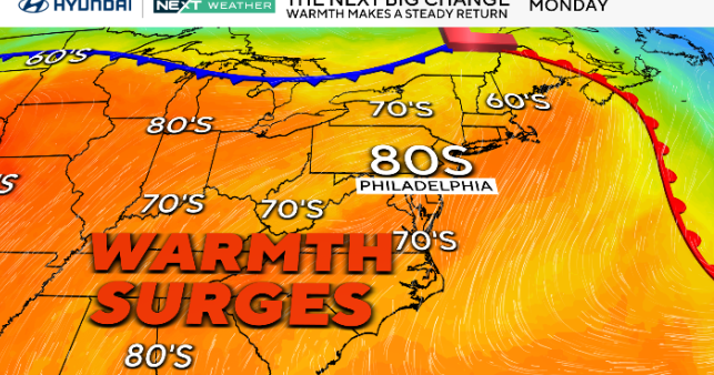
Tuesday turns even warmer. Highs reach the low 80s, with a chance for late-day thunderstorms. An isolated severe storm is possible well north and west of New York City, but the city itself may stay storm-free.
Watching for record highs
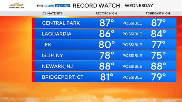
By Wednesday, the heat really peaks. It stays warm with a few isolated thunderstorms, and record high temperatures are possible as highs surge into the upper 80s.