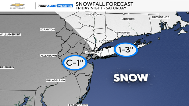
Snow could fall over parts of New York, Connecticut as dangerous cold settles in
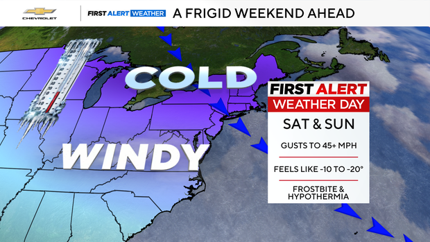
This weekend is shaping up to be one of the coldest we've seen this season, with the potential for snow east of New York City.
A First Alert Weather Day is in effect for both Saturday and Sunday as dangerously cold temperatures settle in.
An Extreme Cold Watch has also been issued from 4 a.m. Saturday through 1 p.m. Sunday for Sullivan, Ulster and Dutchess counties in New York, where wind chills could plummet to an incredible -35 degrees.
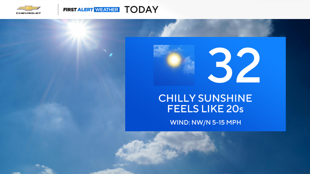
Sunny skies but cold Thursday
Before we even get to the weekend, you might notice some black ice around the area this morning, so take it slow out there.
Thursday starts out 10 to 20 degrees colder than Wednesday, with wind chills running between 0 and 20 degrees. Even though we'll see mostly sunny skies later, highs only reach the low 30s, and it will still feel like the 20s.
The night stays cold, with wind chills settling into the 5 to 15 degree range.
Snow forecast
Friday brings more clouds and some late-day snow showers. Light snow develops, and temperatures tumble again into the evening, with wind chills falling between 10 and –5 degrees.
Then comes the real punch.
Saturday features leftover light snow, mainly east, amounting to a coating to three inches.
But the headline is the cold. Windy, frigid conditions will make it feel like 0 to –10 degrees. Saturday night gets even worse, dropping to –10 to –20 degrees, and down to –20 to –35 degrees across distant northwest suburbs.
Sunday doesn't offer much relief. Expect a blustery, frigid day with wind chills ranging from 0 to 10 degrees.
Bundle up, and stay safe this weekend!