Warmer weather arrives in New York area Sunday after overnight storms
New York City isn't expecting any snow, but that doesn't mean it will be a quiet weather weekend.
Thunderstorms are expected to arrive Saturday in the Tri-State Area after severe weather hit the Midwest on Friday.
Thunderstorms Saturday night
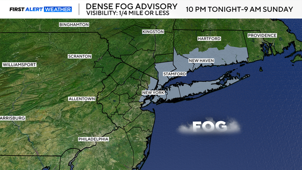
Thick clouds were in place on Saturday, and they'll remain in place through Saturday night. Dense fog is likely to develop, especially along the coast, as well. A Dense Fog Advisory has been issued for New York City, Long Island, northeastern New Jersey, coastal Connecticut, and Westchester County from 10 p.m. Saturday through 9 a.m. Sunday.
Temperatures will actually start to rise overnight as a warm front pushes through. Readings will go from the mid 40s to the low 50s by daybreak.
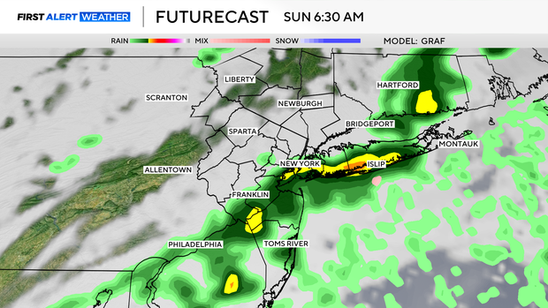
As those temperatures are rising, a line of showers and thunderstorms will be approaching the Tri-State Area. That line, which brought deadly tornadoes to the Midwest on Friday, will lose its punch once it encounters a more stable airmass in our area.
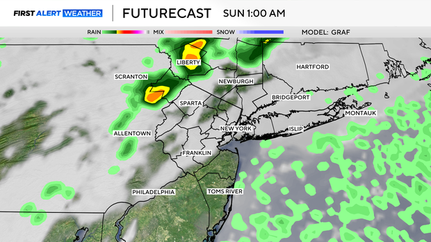
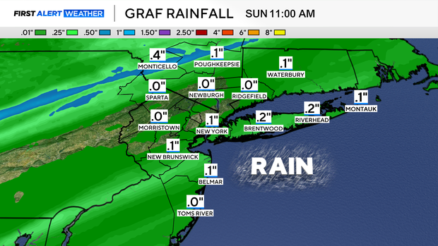
Even though severe thunderstorms are not in the forecast, a few rumbles of thunder are anticipated from late Saturday into Sunday morning. The showers and storms may put down up to a quarter inch of rainfall.
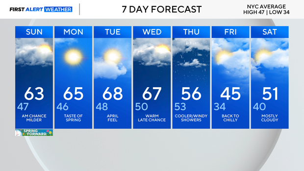
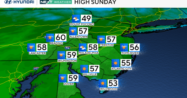
Warm-up Sunday
Showers could linger during the morning hours, mainly south and east of the city. Clouds will then be slow to clear out, but they should eventually do so by the afternoon.
Late day sunshine will help temperatures climb into the low and mid 60s in many locations. Immediate coastal areas will only stay in the 40s and 50s though.
Temps in the 70s?
Even warmer temperatures await us for next week. Highs during the Monday through Wednesday timeframe could reach the 70s in some spots, especially across interior sections of New Jersey.