Warm Wednesday, but significant rain headed our way Thursday

A series of fronts are on the way to the Tri-State Area.
A cold front dropped south into the region late Tuesday into Wednesday, triggering scattered showers and thunderstorms north and west of New York City and spreading east overnight.

Most of your Wednesday is dry but late Wednesday we could see heavy rain start.
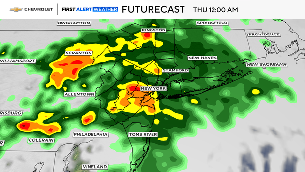
The bulk of the rain looks to be Thursday, which is why we have declared a First Alert Weather Day.
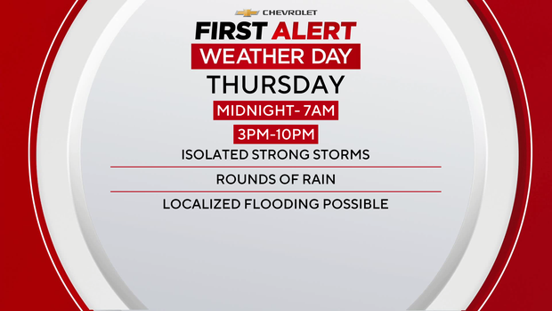
There will be heavy rain and storms midnight until 7 a.m. A second round develops around 2-3 p.m. and will be in the area until 10 p.m. Thursday.
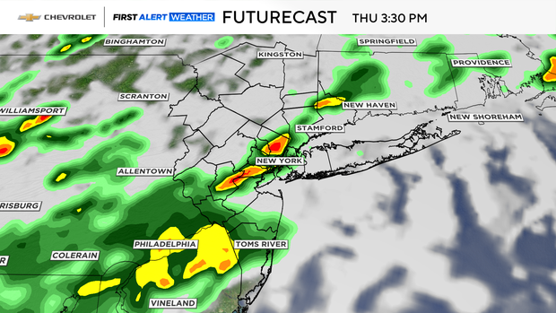
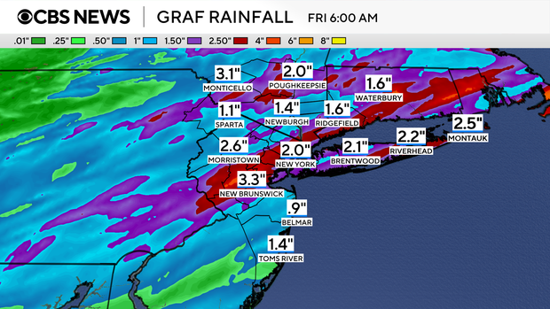
This is mainly a heavy rain event, and it is possible to have some localized flooding.
The Storm Prediction Center has a marginal risk of any of the storms reaching severe limits on Thursday.