What to expect in the Tri-State Area for the remainder of the nor'easter
The nor'easter is winding down, but the Tri-State Area will continue to feel its effects well into Monday.
A First Alert Weather Day will continue through Sunday night due to lingering effects of the nor'easter
A Coastal Flood Warning is in effect for Ocean County, New Jersey until 2 p.m. on Monday.
A Coastal Flood Advisory is in effect for Middlesex, Monmouth, Nassau, Suffolk, Bronx, Westchester, and Fairfield counties through 2 p.m. on Monday.
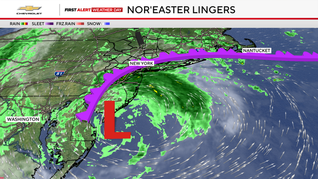
The coastal storm that has been plaguing the region since Friday, will continue to be a presence, but, thankfully, the worst is now over.
This nor'easter proved to be prolific. Not only was it one the earliest storms of its kind this region has ever recorded, it also happened to be the most destructive to occur within the month of September. Total damages are likely to amount to millions of dollars once all is said and done.
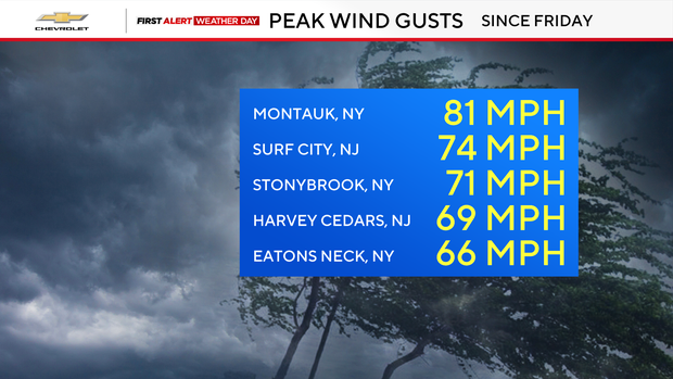
At the height of the storm, scores of customers lost power, due to winds that gusted as high as 60-80 mph. Consequently, those punishing wind gusts led to thousands of trees falling. One fatality occurred as a result of one of those trees coming down in Brooklyn.
However, it was the coastal flooding that perhaps was the most noteworthy hazard associated with this storm. In many coastal locations, the tidal flooding that transpired ranks within the top 10 of such events ever recorded, reaching levels not seen since Superstorm Sandy in 2012. For example, storm surge reached 3.54 feet in King's Point, New York.
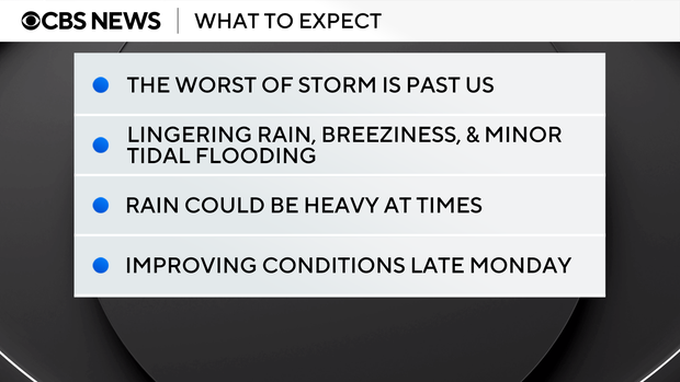
Since landfalling along the Jersey Shore early on Sunday morning, the storm has weakened significantly. It has now moved back offshore of New Jersey and will slowly meander there through Monday afternoon. Even though it is in a weakened state, it will still deliver rounds of moderate to heavy rain for several more hours. Additional rainfall totals are likely to range between 1-2 inches, with isolated higher amounts.
Because the rain will be falling for many hours, the flash flood threat is low but can't be ruled out. Residual wind gusts will range between 30-40 mph before gradually calming on Monday afternoon. In terms of coastal flooding, just some minor flooding can be expected through the next few high-tide cycles, and mainly for back bay areas, particularly the Barnegat Bay in Ocean County.
Looking ahead, temperatures on Monday will only reach the low 60s, but a big warmup then ensues for the rest of the week. From Tuesday through Friday, highs will return to above-average levels, reaching the upper 70s to mid 80s. Some portions of New Jersey could even make a run at 90 degrees on Thursday.