Potential for snow and ice in New York at night but some relief from bitter cold
New Yorkers felt much better on Tuesday as a warm front moved toward the region. But, snow and ice could make for a potentially dangerous evening.
Mostly clear skies early Tuesday morning quickly clouded over, and high temperatures in the mid-30s.
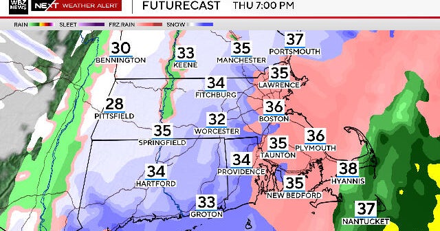
Snow showers later in the day were expected to change over to a period of freezing rain for areas north and west of the city into the night.
A Winter Weather Advisory is in place from 6 p.m. until 6 a.m. Wednesday for Sullivan, Ulster, Dutchess, Orange, Rockland, Putnam, Westchester and Fairfield counties.
A First Alert Weather Day is also in place Tuesday night due to potential icing north and west.
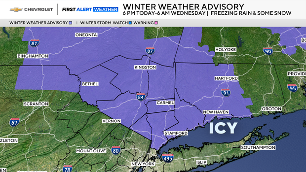
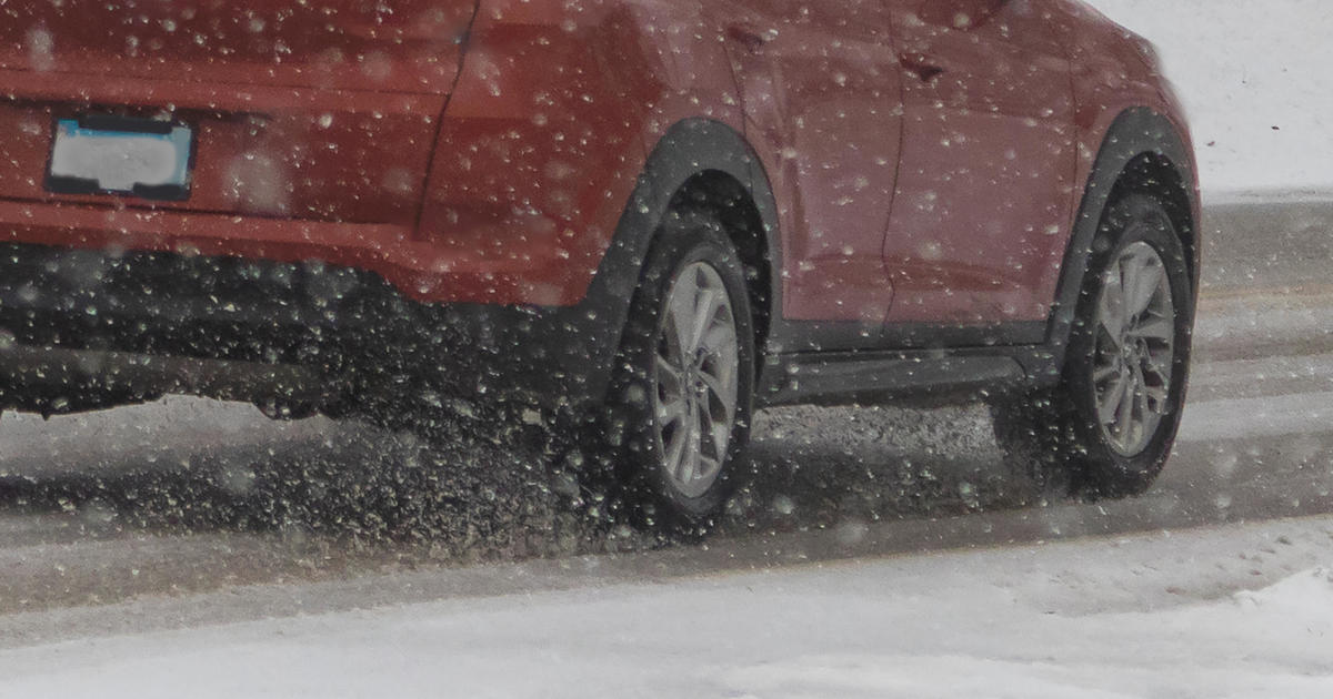
Ice could lead to dangerous conditions
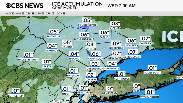
While it isn't expected to accumulate too much, the ice may lead to hazardous sidewalk conditions, glazed-over roads and some downed tree branches.
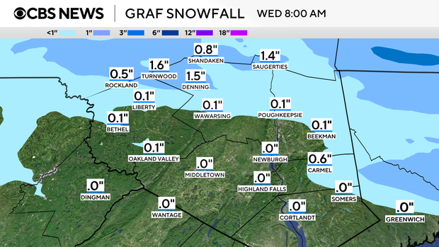
In terms of snow, one to two inches are possible north and west of the city before the changeover.
For areas south and east of the city, a change to plain rain is anticipated before clearing later in the night. Temperatures are likely to hold steady overnight, ranging from the upper 20s to the lower 30s.
Warmup Wednesday
As for Wednesday, sunshine returns, but so do the breezy conditions, with gusts between 25 and 35 mph.
For the first time since Jan. 22, average temperatures will be in place as highs reach the lower 40s.
Looking ahead a little more, highs in the mid to upper 40s are possible by mid to late February.
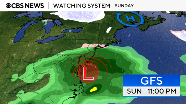
Watching a potential coastal storm
The weather team is still watching a coastal storm that may affect the Tri-State Area later this weekend. Forecast models have been varying widely with their solutions. At the moment, it appears that the storm may bring mostly rain, with some mixed precipitation north and west.