First Alert Weather: Sunshine with highs in mid-to-upper 80s, low humidity
Our nice summer weekend rolls on today with more sunshine and low humidity!
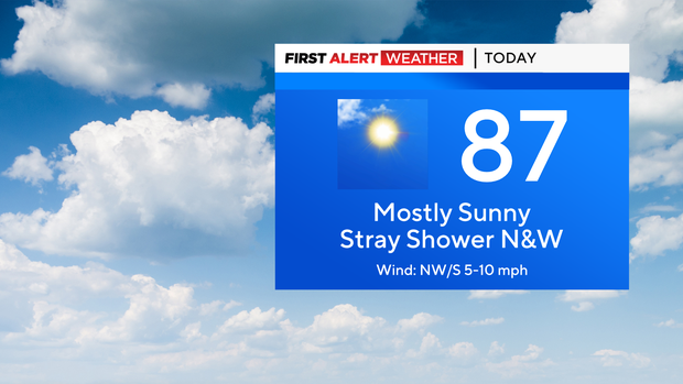
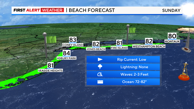
Expect temps to climb into the mid to upper 80s this afternoon. We'll see a mix of sun and clouds and most places will remain dry. If you're north and west of the city, can't rule out a very isolated, spotty shower. Absolutely nothing to cancel plans over and if anything pops, it would be very brief. There's a low risk of rip currents at all area beaches today. And what a beach day it is!
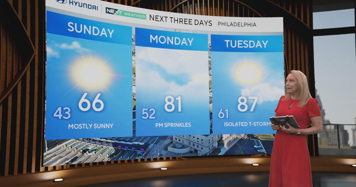
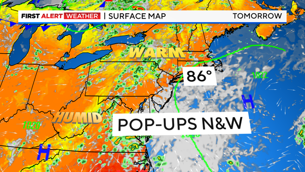
It stays quiet tonight with partly cloudy skies and lows in the 60s and low 70s. As we head into your Monday, the humidity creeps up some and there will be a slim risk of a shower or t'storm inland. Otherwise, expect some more clouds around with temps in the mid 80s.
Tuesday brings a slightly better chance of some afternoon showers/storms. But the much bigger story will be the return of the heat and humidity. In fact, the hottest days yet this summer may be on the way by late week. With the humidity soaring, heat index values above 100 are likely by Friday.
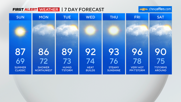
For now, enjoy the rest of this beautiful July weekend!