First Alert Weather: Red Alert Day as Tri-State officially enters heat wave
Alerts: Red Alert for today and this weekend for feels like temps of 95-105. Isolated to scattered thunderstorms are also expected this afternoon, some of which could be strong or even severe.
Yellow alert for tomorrow because it will be hot, but not as humid.
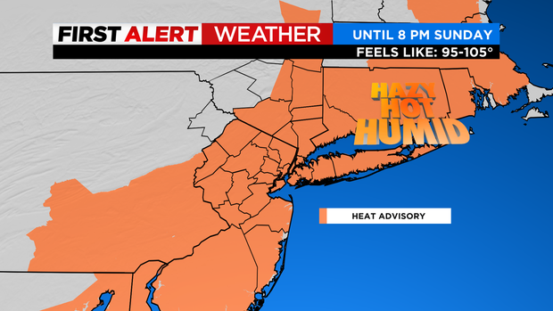
Advisories: Heat advisories in effect through 8 PM Sunday across much of the tri-state area. Heat indices will range from 95-105.
High risk of rip currents along south facing NY beaches today.
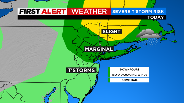
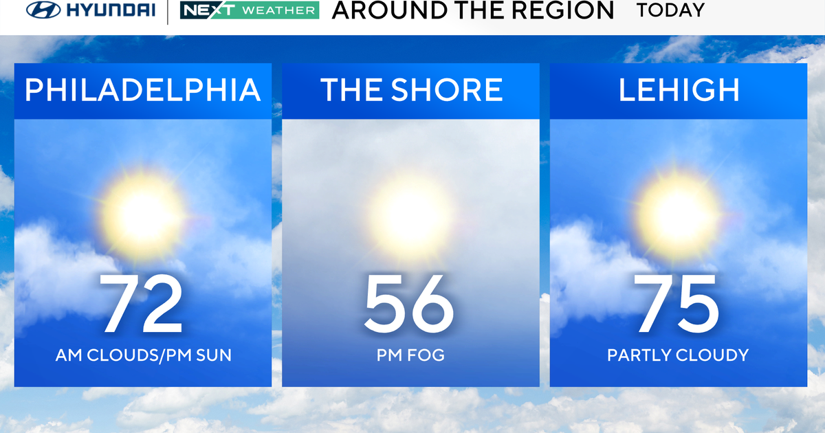
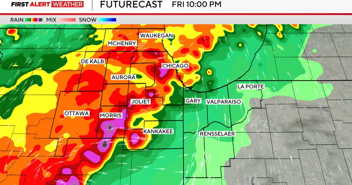
Forecast: Today will feel like 100+ degrees with strong thunderstorms possible this afternoon. At this point it looks like the main threats will be downpours (localized flooding) and isolated damaging wind gusts, but even an isolated tornado can't be ruled out. Things should wind down by 7/8 PM (east) with clearing expected thereafter. It will still be on the warm side overnight with temps only falling into the 70s. As for Friday, it will still be hot, but not as humid with a stray thunderstorm in the afternoon. Expect highs in the low 90s.
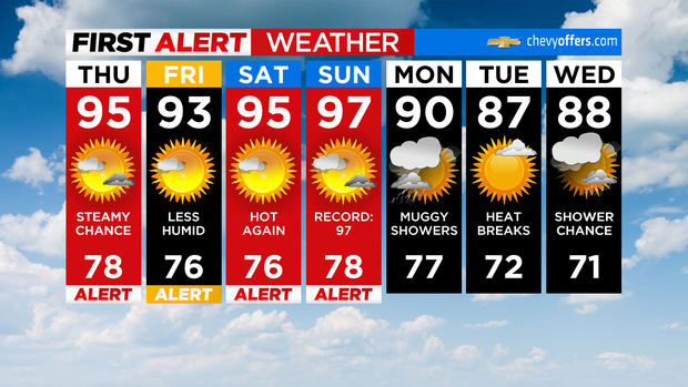
Looking Ahead: As for the weekend, it will be hot and humid with highs in the mid 90s with feels like temperatures in the mid 90s to about 105. In fact, on Sunday we could tie or even break the record high of 97.