First Alert Forecast: Cloudy, round of showers, warm & breezy Sunday
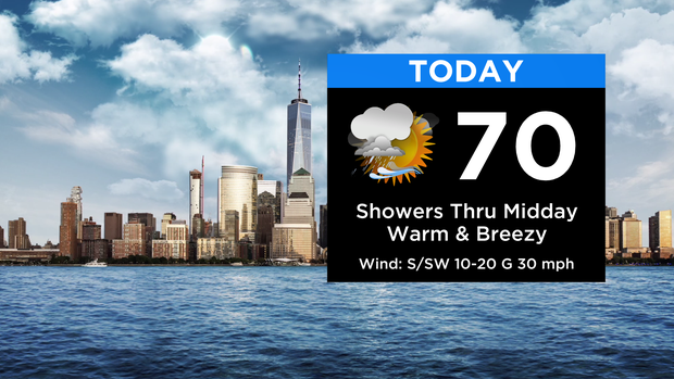
Despite the cloud cover, it'll be feeling like spring out there today! After a round of showers through midday, we're optimistic some breaks of sun should wrap up our Sunday.
Highs will be in the upper 60s to around 70 ... 20 plus degrees above normal for March! It'll be turning breezy with gusts up to 30 mph at times. Other than a few spotty showers around tonight, much of the time will be dry.
Expect patchy fog to develop again late. A cold front moves in from the northwest, but won't make it too far. Lows range from the 30s farther north and west near the front to the mid 50s for the city and points south.
Monday will see a larger difference in temps across the region as a warm front starts pushing north again. Highs will range from the mid 70s south and west of the city in the "warm sector" to only the 50s to the north and east (including the south shore).
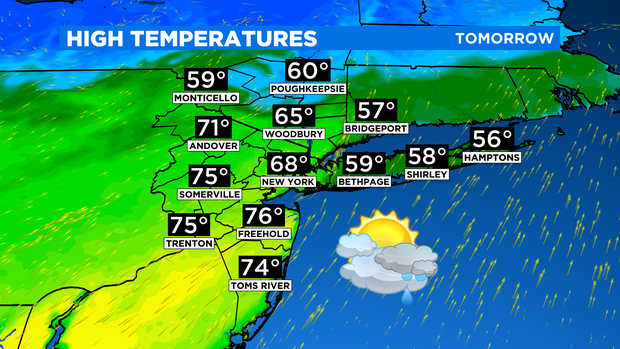
A few morning showers are possible, especially into the Lower Hudson Valley. After a lull in the afternoon, another cold front swings through bringing a period of rain later in the day.
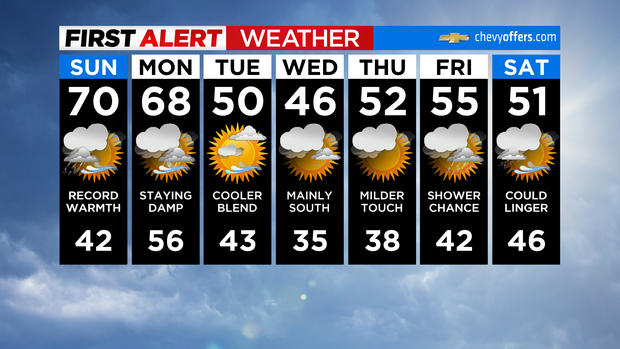
Behind that, temps return close to normal for Tuesday under clearing skies.