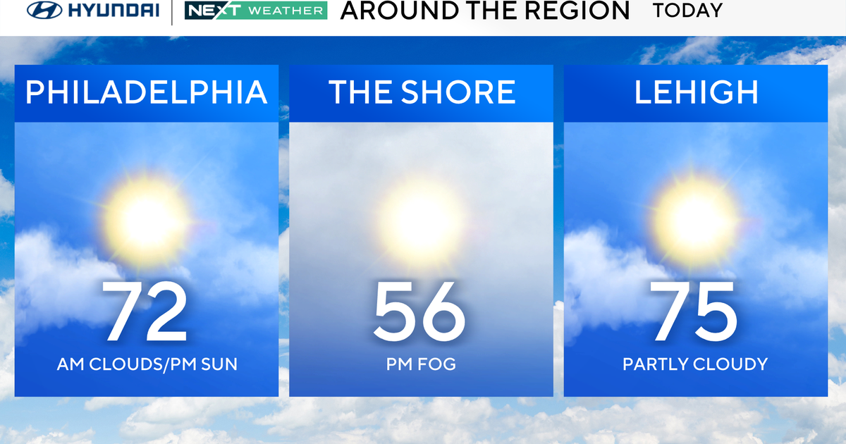
First Alert Forecast: Sunday mid 80s, some afternoon showers; Monday downpours
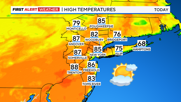
Sunday is the warmer half of the weekend as temperatures climb into the mid to upper 80s this afternoon away from the coast.
Expect high clouds and some sun, with just a very slight risk of an instability shower, but most of the area will remain dry.
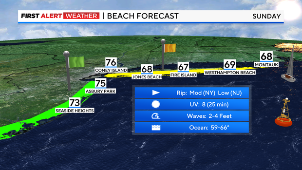
If you're headed to the beach, plan on temps in the 70s. There is a moderate risk of rip currents for the south shore.
Clouds will continue to thicken later today and this evening ahead of our next system. It'll be a mild night with temps falling into the 60s.
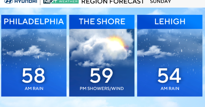
Monday starts off mostly cloudy, but mainly dry. A few scattered showers are possible through the morning hours, but the best chance will hold off until after lunch.
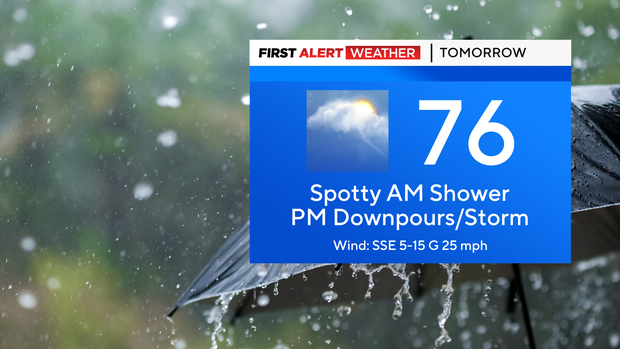
We've issued a Yellow Alert for late Monday afternoon through the evening as some downpours and thunderstorms are likely ahead of a cold front. The risk of widespread flooding is very low, but some isolated pockets will be possible.
It'll be muggy, but cooler with highs in the 70s.
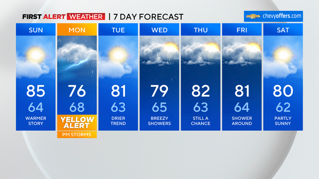
The front moves through late Monday night and, after a lingering shower early Tuesday morning, the sun should return for the rest of the day. We need the rain, but it might slow you down a bit if you'll be on the roads Monday afternoon.
Enjoy the rest of your weekend!