First Alert Forecast: Warm and humid, more storms possible Sunday; Yellow Alert Monday
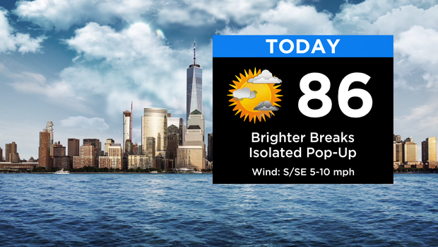
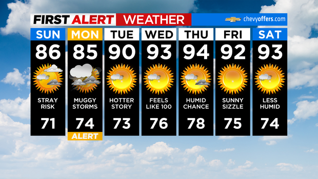
Happy Sunday! Compared to yesterday's scattered soakers, today will be an improvement.
Skies will be a bit brighter with just an isolated risk of a shower or storm this afternoon. It'll be warm and humid with highs in the mid 80s once again. The beaches will be slightly cooler, topping out in the upper 70s.
Clouds thicken again this evening ahead of our next system approaching. A few showers or rumbles will be out there, but most of the widespread activity will arrive closer to daybreak. It'll be very muggy overnight with temps only dropping into the low and mid 70s.
We've gone ahead and made Monday a Yellow Alert Day.
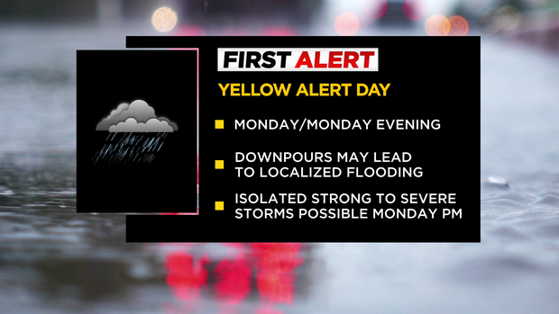
A few rounds of showers and thunderstorms are likely, which could be on the strong side in the afternoon. Downpours may lead to localized flooding and ponding on the roadways, and damaging wind gusts would be the main threat in any storms.
After tomorrow, the big story will be the heat.
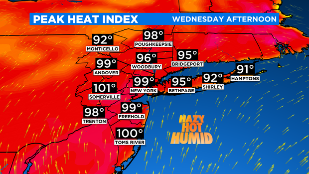
We're not expecting records or anything, but it sure will be an extended period of hotter temps.
A heat wave is looking likely with highs in the 90s starting Tuesday. With oppressive dew points, heat index values will approach 100 by midweek.
Enjoy the rest of your weekend!