First Alert Forecast: Cold and blustery, flurries north of New York City
It's another chilly and breezy afternoon to close out the weekend. Expect a mix of sun and clouds with highs struggling to get out of the 30s. With the wind, it'll feel more like the 20s at times.
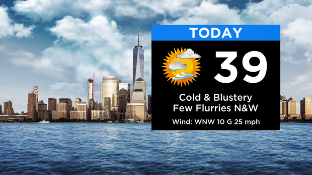
A few flurries are possible, mainly to the north and west.
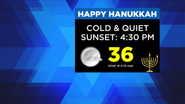
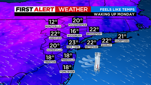
Expect a quiet start to Hanukkah this evening with temps in the mid 30s around sunset. We'll fall into the 20s overnight, with some wind chills in the teens waking up Monday morning.
The beginning of the new week remains quiet and chilly. We're dry through Wednesday before our next storm system rolls in late week.
As of now, it's looking more like a rain event for many with perhaps some snow in the mountains. Either way, winds will be cranking, and arctic air will rush in behind.
We'll go from near 50 Friday morning to single-digit wind chills by Christmas Eve!
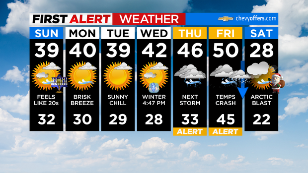
This will be a dynamic storm, so as always, stay tuned this week for any changes. Enjoy the rest of your weekend!