First Alert Forecast: Upper 80s, lowering humidity and plenty of sunshine!
What a night it was, as strong storms rocked the area! They put on quite a lighting show for people who were up and featured damaging winds, as well as torrential rain.
There were even a few tornado warnings at one point during the night, though no tornadoes have been reported as of now.
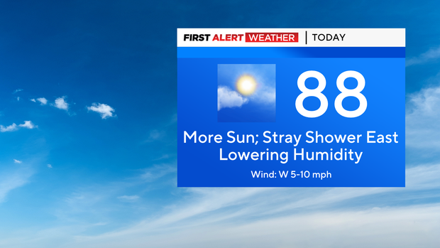
The storms are just a memory now, and skies are clearing. This will set the stage for a much-improved Sunday, that will feature lots of sunshine and humidity lowering throughout the day. The only exception will be extreme eastern Long Island, which may see a passing shower.
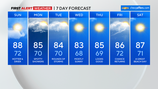
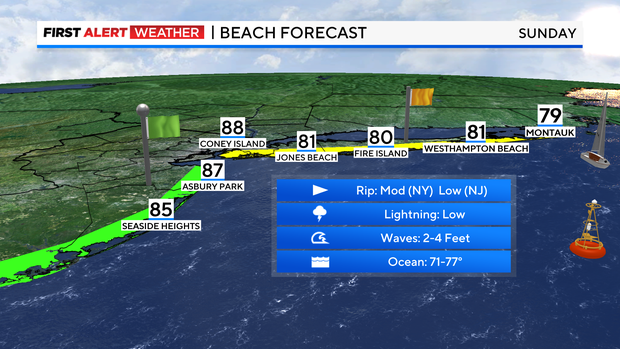
It will be a hot one, with highs in the mid to upper 80s. Some parts of New Jersey may hit 90. A great beach day for sure.
Tonight, skies remain mostly clear. It will be very comfortable and great for sleeping. Lows will range from 70 in the city to upper 50s in our far northern suburbs.

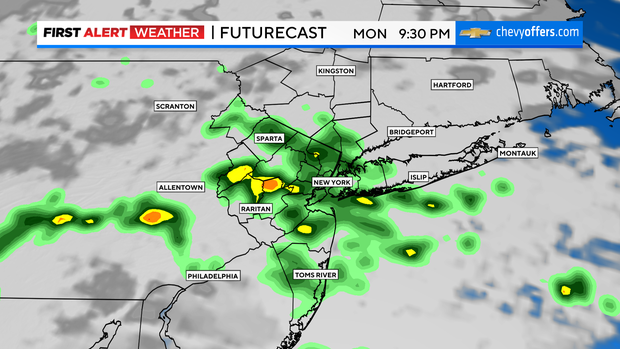
Monday starts off dry, then clouds increase throughout the day. Spotty light showers are also possible. At the same time, humidity starts to rise again. Highs will be in the low to mid 80s.
Showers and storms will become more numerous into Monday night and last throughout Tuesday.

Another round of severe storms is possible during this timeframe, especially for Tuesday evening. Once again, heavy rainfall will be a concern. Possible totals are 1 to 3 inches.