First Alert Forecast: Dramatic cooldown and windy Saturday, back to mid 70s Sunday
What a change! We were sweating yesterday with the high humidity and temps in the upper 80s to low 90s. Today, it's feeling more like early May!
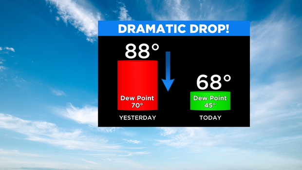
Last evening's cold front has ushered in a much cooler air mass with highs only reaching the upper 60s and low 70s today. In fact, the mountains likely won't get out of the upper 50s. In addition, a steady northwest wind will be gusting 30-35 mph at times.
Expect more clouds to roll through this afternoon. Not a bad day ... just not very summery.
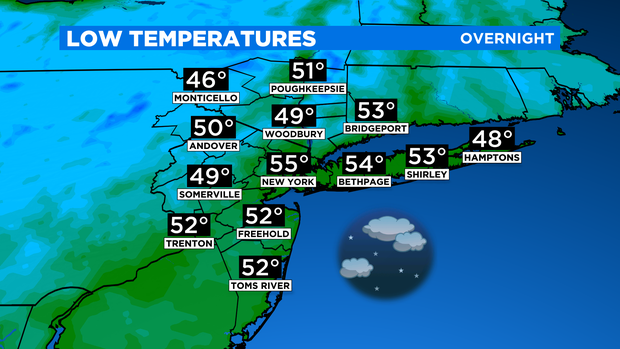
Tonight is very cool for early June as temps fall into the 50s around the city, and even some 40s to the N&W. Most of us will remain dry, but a few showers are possible for the Twin Forks as another weak trough swings through.
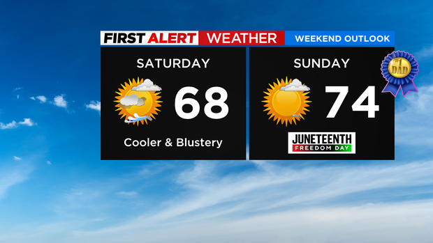
For Sunday, things are looking great for both Father's Day and Juneteenth (which is observed on Monday, since it falls on a weekend). Expect mostly sunny skies and temps in the mid 70s. It won't be quite as blustery, but we'll still have gusts around 25 mph.
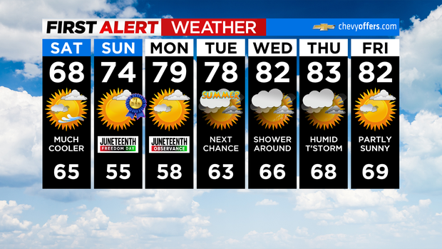
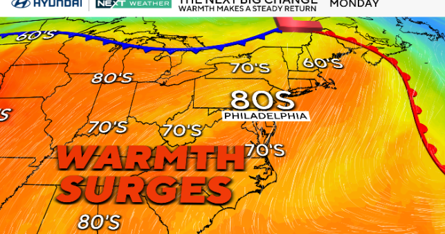
The nice weather continues right into Monday with highs in the uppers 70s and low 80s. Our next area-wide chance of showers is on Tuesday.
Have a great weekend!