First Alert Weather: Snow totals reach 1 foot in Central New Jersey, 10 inches in part of NYC overnight
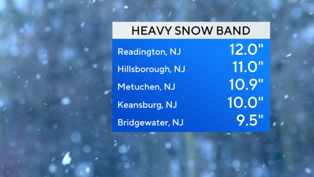
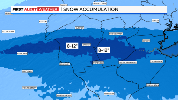
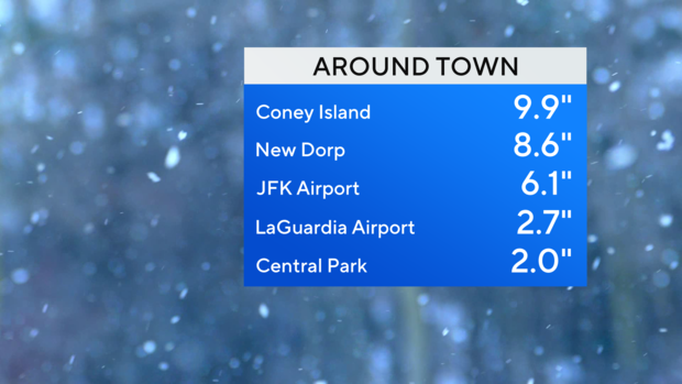
Snow totals
Our early morning storm is pulling away and taking the steadiest snow with it Saturday.
If you were under that heavy snow band in Central New Jersey, you woke up to a foot of snow in spots!
Unfortunately, it's near impossible to forecast that, especially when the band is only 5 to 10 miles wide. But it's incredible to see.
Even within New York City, totals range from 2 inches in Central Park to near 10 inches at Coney Island. Staten Island and southern parts of Brooklyn also got in on that heavier band.
At its peak, snowfall rates were 2 to 4 inches per hour along a line from Hunterdon through Somerset and Middlesex counties.
Outside of that, totals were more in line with expectations. The plus side is even where the biggest totals occurred, it's a very light and fluffy snow (part of why it really piled up so fast).
Saturday forecast
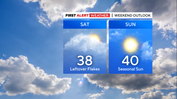
Some flurries or a snow shower can still be around this afternoon, but no more accumulation is expected. Gradual clearing will allow for some breaks of sun as well.
Highs will be in the upper 30s to low 40s.
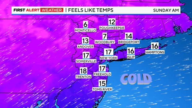
Tonight will be colder with lows in the 20s, but feeling like the teens. Any untreated pavement will freeze overnight, so watch out for slick spots!
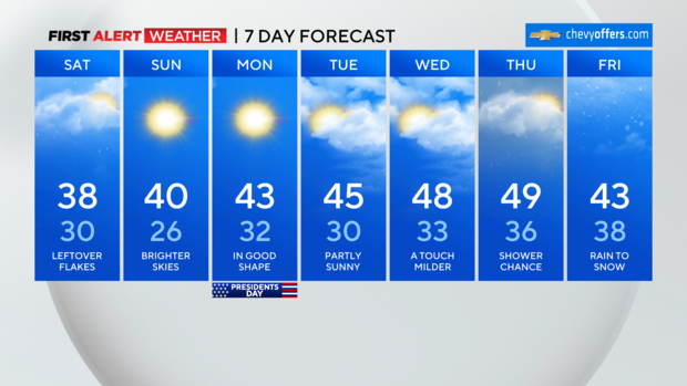
Sunday will be brighter and breezy with highs around 40.
We stay dry into next week with a slow warming trend.