First Alert Forecast: Cool weekend, clouds Saturday, tricky Sunday
It's a cooler weekend overall, but still not bad! Today will feature partly to mostly cloudy skies. More clouds will filter in through the afternoon hours. Highs will be in the low 60s.
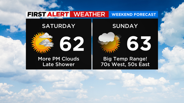
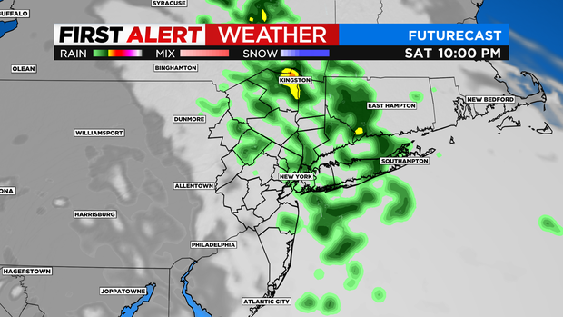
Some showers move through later tonight. By no means is it a washout, but ... take an umbrella if you're heading out after sunset, just in case. They'll be light, no big deal.
Lows will fall into the 40s overnight.
Tomorrow will be a tricky one!
A backdoor cold front works through from the northeast, bringing an onshore flow. Whatever the front sets up will dictate the afternoon temps for you. Highs will likely range from near 70 far west/inland to the 60s around NYC, and only the 50s to the east. Central Pennsylvania will climb into the 80s!
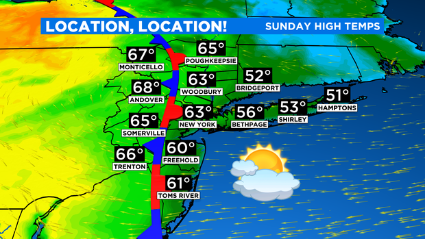
The good news is after some lingering drops early on, much of the day will be dry with more sun the farther west you go.
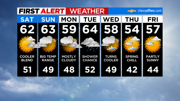
Heading through next week, temps remain below normal. Our best chance of rain comes on Tuesday. Have a good one!