Cold alerts in NYC and Tri-State Area this morning, but a warmup is coming
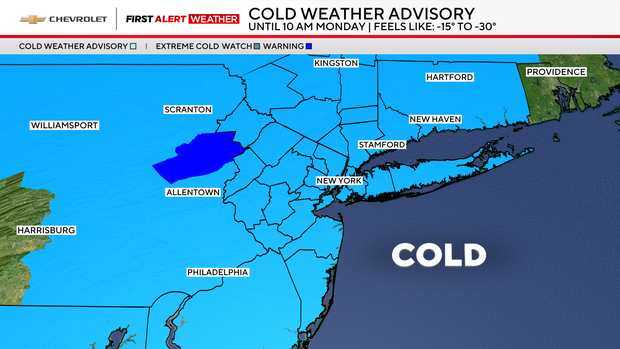
A Cold Weather Advisory is in place through 10 a.m. on Monday for the entire Tri-State Area.
As a result, a First Alert Weather Day will be in play for at least part of the day.
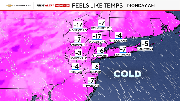
With such an exceptionally cold air mass in place, you'd expect low temperatures not experienced in a while. That's exactly what happened on Sunday morning when the mercury dipped to 3 degrees in Central Park -- the coldest temperature recorded since Feb. 4, 2023.
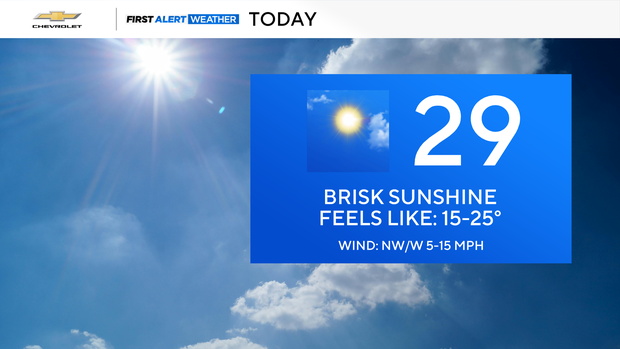
Monday begins the warmup
Once Monday morning's lows bottom out, temperatures will recover nicely, climbing into the upper 20s to around 30 degrees by the afternoon. Although highs in the upper 20s are still cold, it will feel noticeably warmer, especially with sunshine in place.
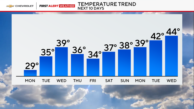
Temperatures will rise even further during the rest of the week, reaching the mid and upper 30s. The low 40s are not out of the question, either.
Looking ahead a little more, highs in the middle 40s are possible by mid to late February.
Not much snow expected this week
In terms of precipitation, not much is expected during the upcoming week. The only chance comes on Tuesday, when a warm front will bring a few snow showers to the region.
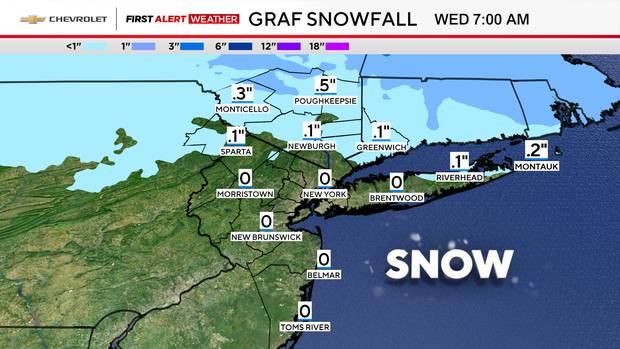
Most locations will receive no accumulation, except for areas north and east of the city, where up to a half inch of snow may fall.
Late next weekend, a coastal storm could bring a mix of rain and snow to the Tri-State Area. That system will be watched closely, as some forecast models suggest it may be strong.

