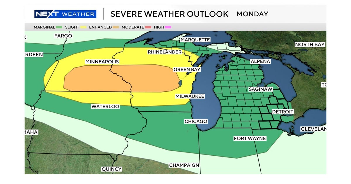
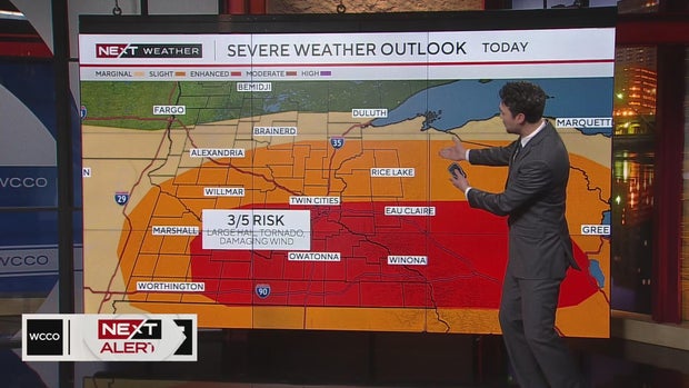
Severe storms possible Monday afternoon with risk for hail, strong winds in Twin Cities


A warm and humid Monday will lead into an afternoon of possible severe weather in central and southern Minnesota.
WCCO issued a NEXT Weather alert as there's an enhanced risk for severe storms in the Twin Cities. There's a chance for large hail and damaging winds, with the potential for tornado warnings.

Temps will top out in the low 70s Monday afternoon. The storms will then start to develop around 4 p.m. and continue into the evening.
The initial wave will be the strongest, NEXT Weather meteorologists say, but they will gradually get weaker overnight as the front slips to the south.
Tuesday morning, a few clouds will linger, and there's the chance for some spotty showers in southern Minnesota.
Another round of showers and thunderstorms are possible, especially later in the day on Wednesday.
High temperatures are mainly in the 70s this week before dropping into the 40s on Saturday.