NEXT Weather: Monday morning chill gives way to cool, sunny day

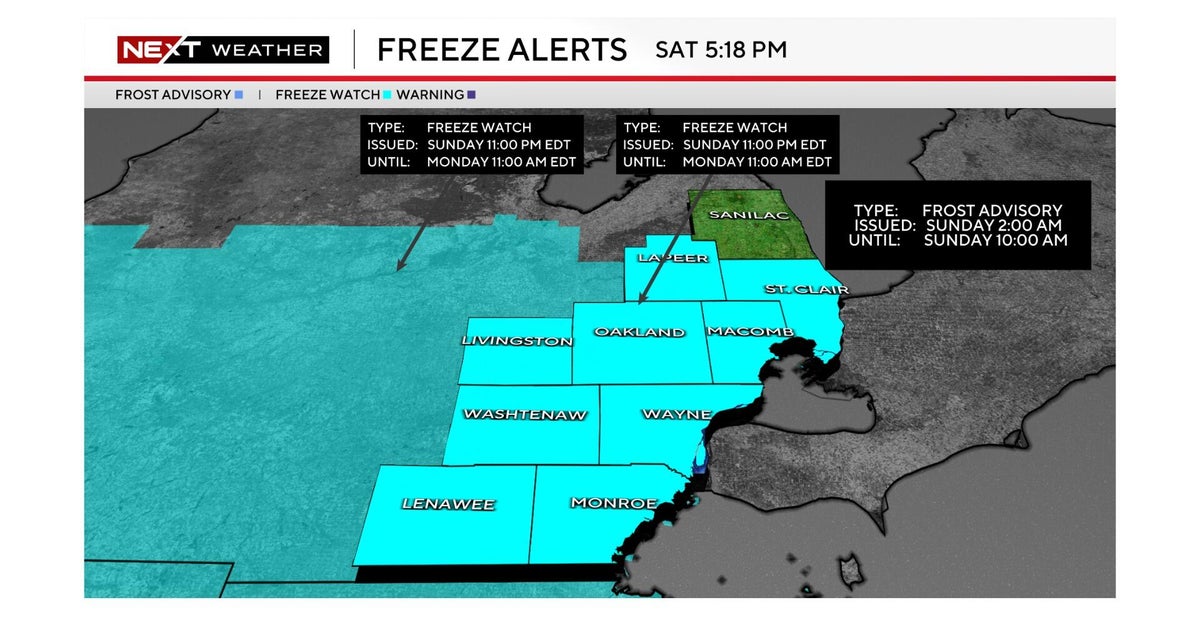
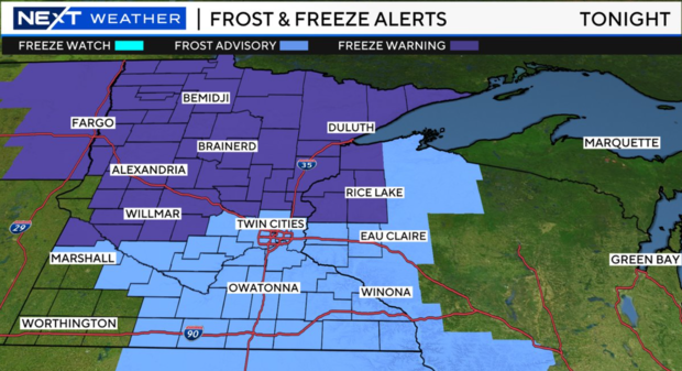
MINNEAPOLIS — Twin Cities temperatures are expected to dip to the coldest they've been in months and months, with some areas looking to experience potentially freezing temperatures.
Another round of frost, along with that potential freeze, is expected Monday night into Tuesday, mostly in rural areas. High temps stay in the 50s all week.
WCCO meteorologist Lisa Meadows says we are still running about 5 to 10 degrees below average for this time of year, with highs in the 50s this week and lows in the 30s and 40s.
Rain isn't expected to make an appearance until possibly late in the week, likely by Thursday.
Winter outlook
A new winter outlook is out and it's sharing what we could expect for the coming months.
Last year was one of the snowiest winters on record in the Twin Cities, with more than 90 inches of snow. If you're looking for a repeat, scientists say El Niño will make that tough. El Niño occurs when sea surface temperatures in the equatorial Pacific are warmer than average. El Niño, and its opposite phase, La Niña, are just one factor that can create global weather extremes.
Through winter's core, December through February, the Climate Prediction Center says there are increased chances for a warmer-than-average winter across Minnesota this year.
As for precipitation, it's a little more of a toss-up for the Twin Cities with equal chances for above, below or near-normal rain and snow. Across northern Minnesota, it's a little more likely that we're drier than average.